


CLEVELAND — After some morning mist and drizzle, it has cleared out and even made way for a few peeks of sun. More peeks the farther west you are, and high temperatures there can briefly jump into the lower 50s. It will be on either side of 50º this afternoon in Cleveland. Enjoy it. It won't last.
Chilly weather comes back for Christmas Eve and Christmas Day. Highs in the upper 30s to around 40 on Christmas Eve and lower 40s at best on Christmas Day. This is a big departure from earlier projections from the weekend, and Allan will have a deeper dive on that later this evening online, so check that out.
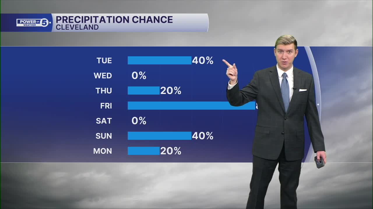
We'll be watching Friday closely, with more rain, but models are showing signs of freezing rain to start, especially in the snowbelt, so stay tuned!
DAILY FORECAST:
Tuesday: Drying out early, followed by a big rebound. | High: 50º
Christmas Eve: Back to the cold. | High: 38º
Christmas Day: Isolated morning showers. | High: 40º
Friday: Rain, freezing rain, and sleet all likely. | High: 40º
Saturday: Cool & dry. | High: 42º
Sunday: A few showers and t-storms possible. | High: 52º
Monday: Much colder. Lake effect snow possible. | High: 25º
Want the latest Power of 5 weather team updates wherever you go? Download the News 5 App free now: Apple|Android
Click here to view our interactive radar.
Follow the News 5 Weather Team:
Trent Magill: Facebook & Twitter
Katie McGraw: Facebook & Twitter
Phil Sakal: Facebook & Twitter
Allan Nosoff: Facebook & Twitter
