


CLEVELAND — Hello June! Filtered sunshine, comfortable temperatures, and low humidity on the docket for the first few days of June!
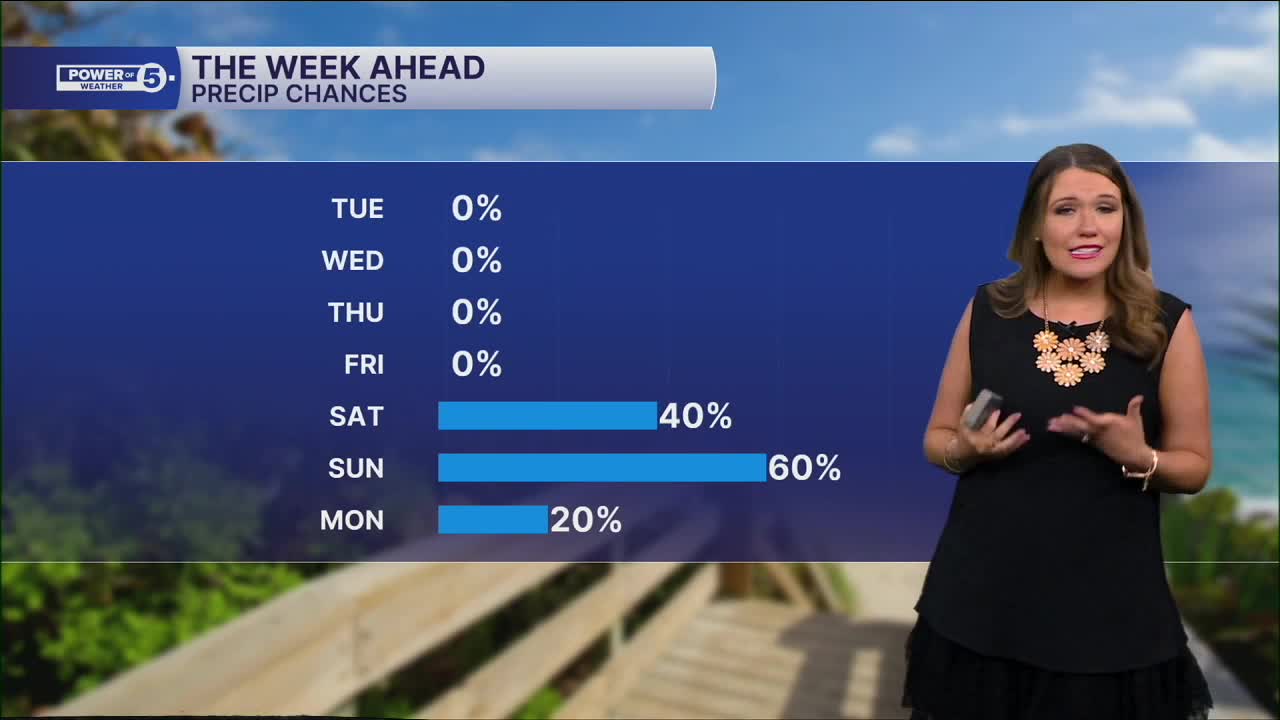
After a cooler-than-normal May, temperatures will remain slightly below par for the next couple of days, with many in the low to mid-70s for daytime highs through Wednesday afternoon. Then we'll begin the warming trend to wrap up the week, along with more noticeable humidity. As temperatures increase, so do the rain chances.
Highs by Friday and into the start of the weekend will be in the low to mid-80s. Dry weather will stick around on Friday, rain chances returning this weekend for the first time in nearly 2 weeks. While it is too soon to discuss exact timing or placement of showers and storms, it is not a bad idea to plan for showers and storms for any outdoor events you may have this weekend.
DAILY FORECAST:
Monday Night: Cool and quiet. Colder inland.| Low: 52º
Tuesday: Mostly sunny and comfortable.| High: 71º
Wednesday: Mostly sunny and comfortable.| High: 75º
Thursday: Mostly sunny and warmer.| High: 80º
Friday: Warmer & more humid.| High: 84º
Saturday: Few storms. Warm & muggy.| High: 79º
Sunday: Few storms. Muggy.| High: 79º
Want the latest Power of 5 weather team updates wherever you go? Download the News 5 App free now: Apple|Android
Click here to view our interactive radar.
Follow the News 5 Weather Team:
Trent Magill: Facebook & Twitter
Katie McGraw: Facebook & Twitter
Phil Sakal: Facebook & Twitter
Allan Nosoff: Facebook & Twitter
