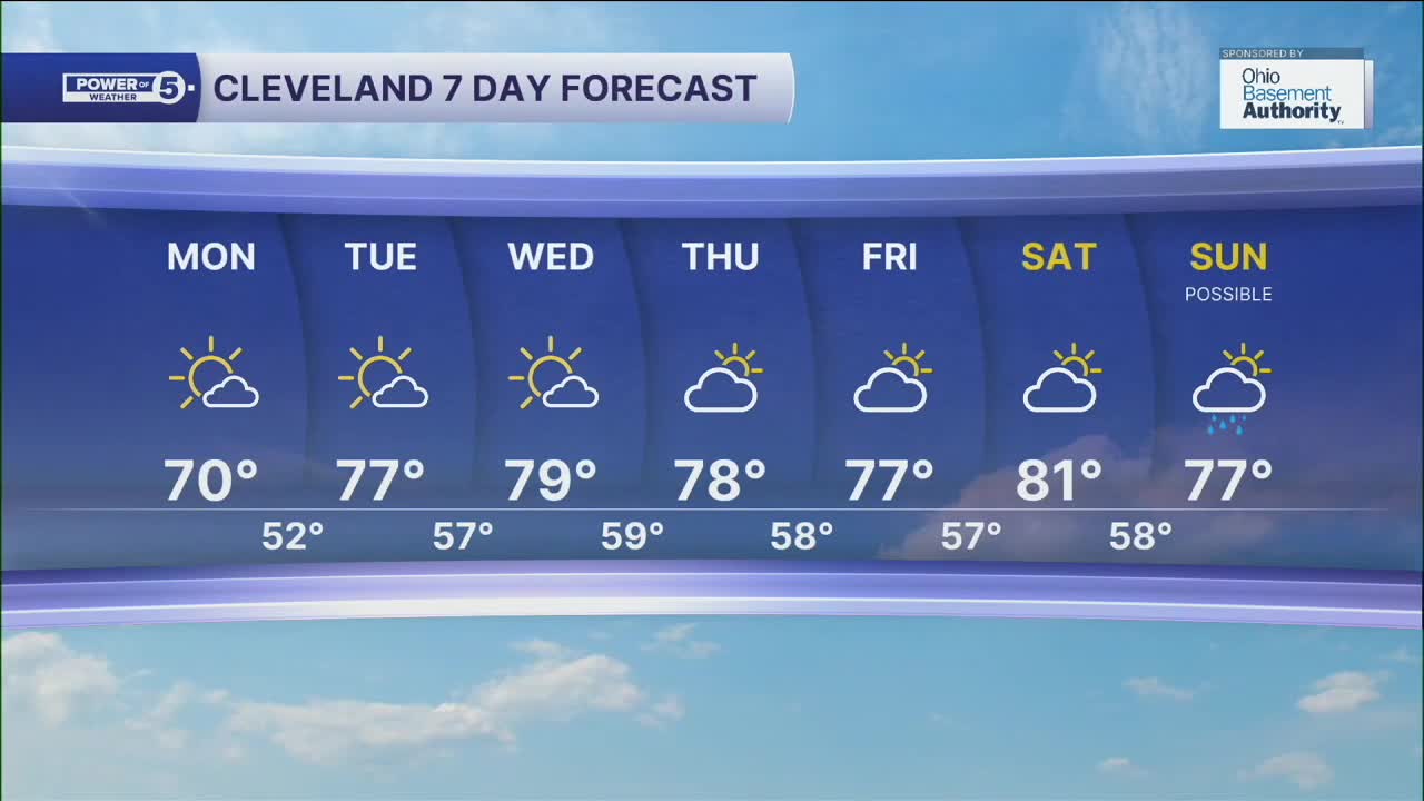


CLEVELAND — A slight chance of a shower, otherwise, temperatures will be slightly warmer to begin the new work week, as highs top off around 70 Monday afternoon.
More seasonal and even above-average warmth moves in for the rest of the work week into next weekend. Highs will be in the upper 70s and lower 80s Tuesday through Sunday.
Rain chances will be slim to nil for the next week, with showers possible on Sunday. Otherwise, anticipate mostly sunny to partly cloudy skies and dry conditions through Saturday across NEO!
DAILY FORECAST:
Monday: Still cool but bright. | High: 70º
Tuesday: Sunny and warmer. | High: 77º
Wednesday: Mostly sunny and even warmer. | High: 79º
Thursday: Partly sunny and seasonal. | High: 78º
Friday: Partly sunny. Right on Par. | High: 77º
Saturday: Partly sunny and a touch warmer.| High: 81º
Sunday: More clouds. Rain showers possible. | High: 77º
Want the latest Power of 5 weather team updates wherever you go? Download the News 5 App free now: Apple|Android
Click here to view our interactive radar.
Follow the News 5 Weather Team:
Trent Magill: Facebook & Twitter
Katie McGraw: Facebook & Twitter
Phil Sakal: Facebook & Twitter
Allan Nosoff: Facebook & Twitter
