


CLEVELAND — It has been a struggle through the 60s for highs Saturday across Northeast Ohio. With a mostly clear sky, especially inland, temps will fall back into the 40s overnight.
Grab the jacket or an extra layer first thing Sunday morning. Lows will be in the 40s and low 50s at the lake. This also means if you are planning to get up early for tailgating for the Browns Game, it will be a chilly start to game day. There is also a possibility of lake effect rain showers on Sunday, especially in the morning. The current trend has us drying up around kickoff or in the first half on Sunday afternoon.
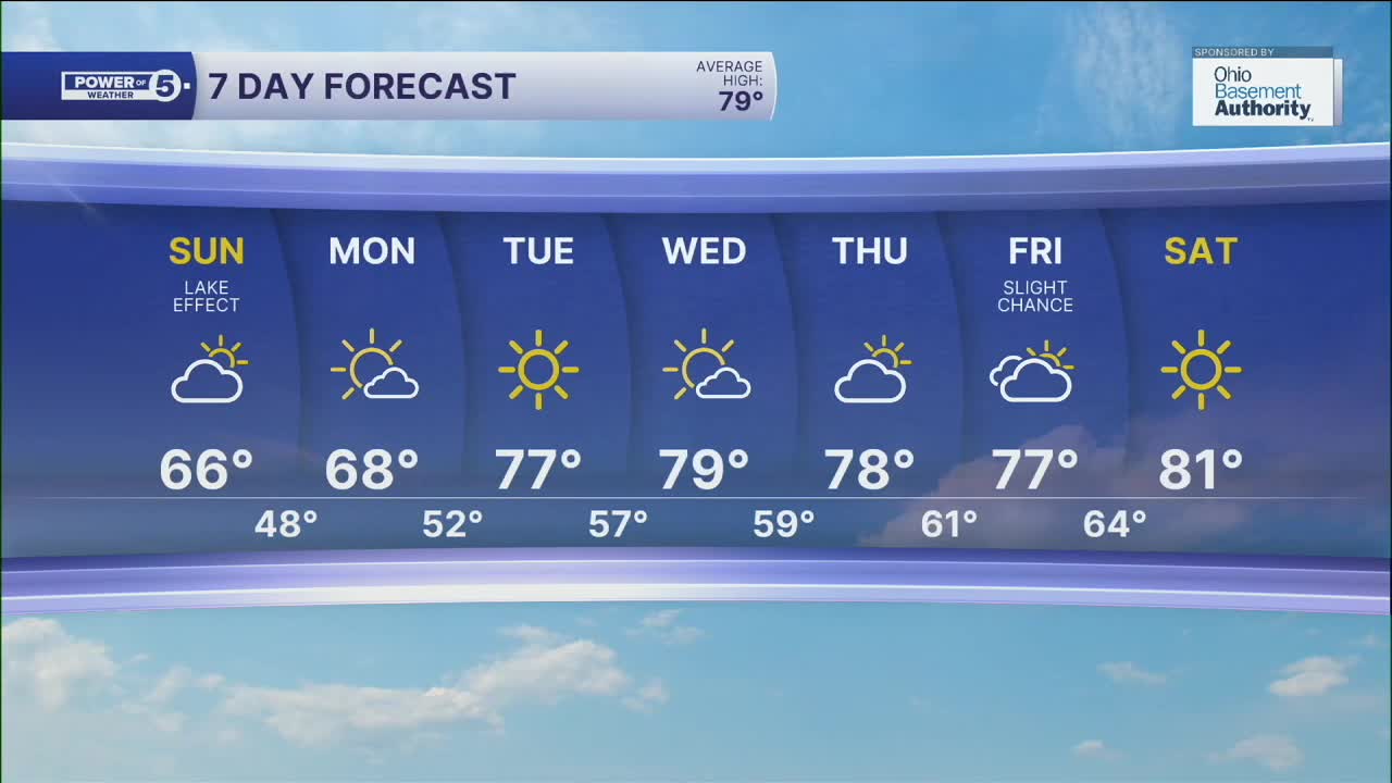
The new work week will start below average as well, with highs only in the 60s on Monday, but the rest of the week looks much warmer and drier!
DAILY FORECAST:
Tonight: Chilly. Good viewing for full moon inland, lake effect showers develop north. | Low: 50º
Sunday: Cool & breezy with lake effect showers possible. | High: 66º
Monday: Still cool but brighter. | High: 68º
Tuesday: Sunny and a bit warmer. | High: 77º
Wednesday: Mostly sunny and even warmer. | High: 79º
Want the latest Power of 5 weather team updates wherever you go? Download the News 5 App free now: Apple|Android
Click here to view our interactive radar.
Follow the News 5 Weather Team:
Trent Magill: Facebook & Twitter
Katie McGraw: Facebook & Twitter
Phil Sakal: Facebook & Twitter
Allan Nosoff: Facebook & Twitter
