


CLEVELAND — Highs may not break 70° in many areas on Monday and Tuesday. This much cooler air (60s) moving over a "warm" Lake Erie will bring the threat of lake-effect rain to some on Monday, especially Monday night, and possibly lingering into Tuesday. Thunder will be possible, along with Waterspouts, so you will want to remain on shore in the coming days.
Temperatures at night will drop into the 40s for many inland Tuesday morning, and the coldest morning will be on Wednesday. Lows in Downtown Cleveland could be as chilly as 52 degrees. Some records will be tested Monday night and again Tuesday night!
It will gradually get warmer by the end of the workweek, along with rain chances returning late Thursday into the weekend.
DAILY FORECAST:
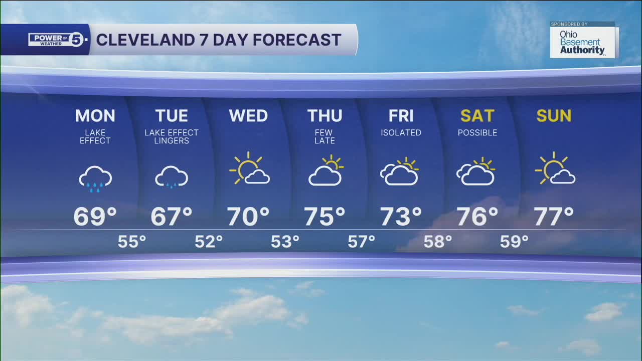
Monday: A taste of fall. Lake effect rain showers and cooler.| High: 69º
Tuesday: Cooler again. Lake effect rain showers are still possible.| High: 67º
Wednesday: Cold start. Brighter but still cool. | High: 70º
Thursday: Partly sunny. Few showers possible late. | High: 75º
Friday: Isolated showers. Cooler. | High: 73º
Saturday: Shower possible. Partly sunny. Touch warmer. | High: 76º
Sunday: More sunshine. Still below avg. | High: 77º
Want the latest Power of 5 weather team updates wherever you go? Download the News 5 App free now: Apple|Android
Click here to view our interactive radar.
Follow the News 5 Weather Team:
Trent Magill: Facebook & Twitter
Katie McGraw: Facebook & Twitter
Phil Sakal: Facebook & Twitter
Allan Nosoff: Facebook & Twitter
