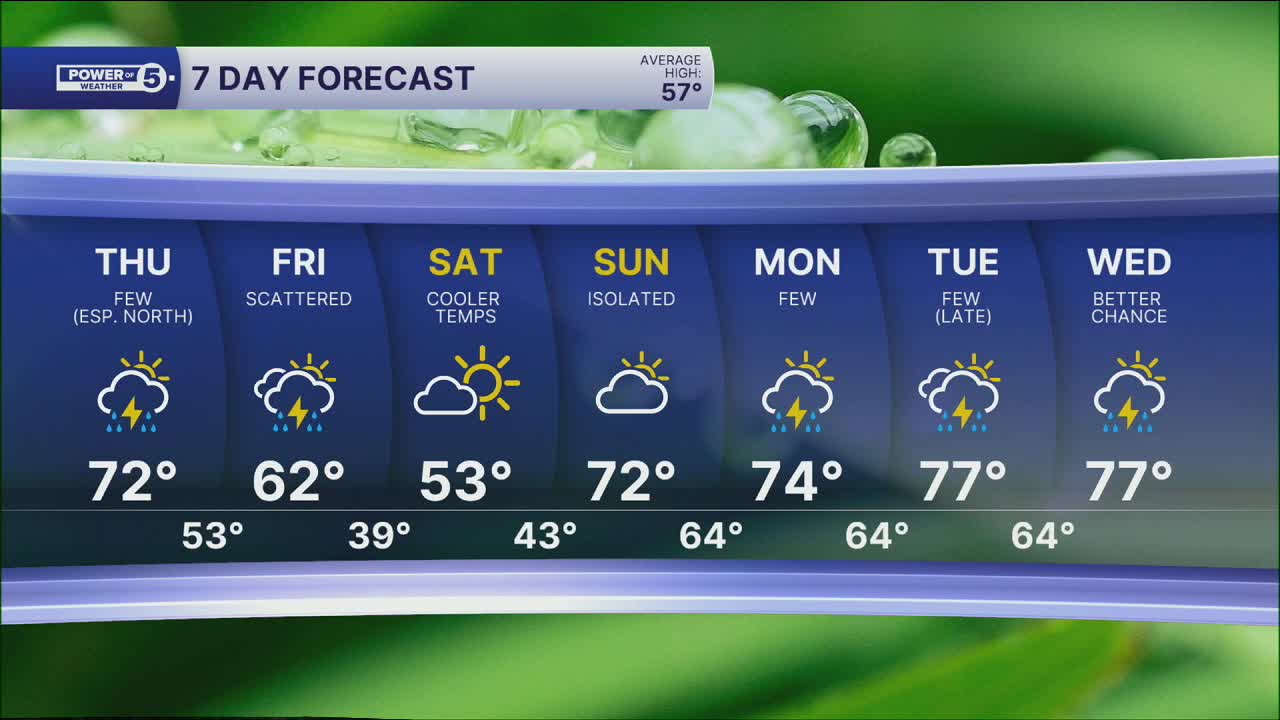


CLEVELAND — It was MUCH warmer on Wednesday, thanks to a southerly wind. As high pressure pulls away from NEO and our next system approaches, we'll start to see more clouds rolling in this evening and tonight. This will keep overnight and morning temperatures milder. Headed out the door for work or school, temperatures will be in the 40s!
Temperatures will bump up even more on Thursday. That warmth comes with rain, though. A few t-showers roll in during the afternoon and continue into the evening. The best chance to see this rain is in the northern half of our viewing area.
The better chance for everyone to get some rain comes on Friday with more widespread activity. As always, we will be watching for anything strong, but the severe threat for both days looks low.
Temperatures will take a dip by Saturday, but not as dramatically as we have grown used to over the last few weeks. Plan on 40s and 50s as opposed to 20s and 30s!
This weekend looks mainly dry as well, with more warmth by Sunday. Storm chances increase by next week.
DAILY FORECAST:
Thursday: Warmer with a few t-showers late in the day, especially farther north.| High: 72º
Friday: Warm & breezy with scattered rain & storms.| High: 59°
Saturday: Cooler. Mainly dry.| High: 52°
Sunday: Warmer again with isolated rain possible.| High: 70°
Want the latest Power of 5 weather team updates wherever you go? Download the News 5 App free now: Apple|Android
Click here to view our interactive radar.
Follow the News 5 Weather Team:
Trent Magill: Facebook & Twitter
Katie McGraw: Facebook & Twitter
Phil Sakal: Facebook & Twitter
Allan Nosoff: Facebook & Twitter
