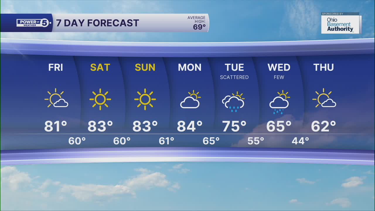


CLEVELAND — HOTOBER! Highs on Friday got into the low and even middle 80s. While not record heat, it is getting pretty close to it, especially later this weekend.
It will be cool tonight with lows in the low to mid 50s away from the lakeshore, but it will be a couple degrees milder closer to the lake, in the upper 50s and low 60s. It will be quiet, clear and calm overnight.
It continues to heat up this weekend, with highs soaring from the low 80s to even the mid-80s.
Despite the lower sun angle, make sure to stay protected with sunscreen; sunburns are still possible this time of year within an hour of direct exposure.
I know, it's October and feels like July, but we will get there.... and soon!
Our stretch of dry days will finally come to an end on Tuesday. Plan on scattered rain on Tuesday and Wednesday, followed by much cooler air mid-week. We actually look to fall BELOW average by then!
DAILY FORECAST:
Tonight: Mostly clear and comfortably cool. | Low: 57º
Saturday: Bright & hot (for October) | High: 84º
Sunday: Super sunny & very warm. | High: 84º
Monday: More clouds but staying very warm. | High: 84º
Tuesday: Scattered rain showers and t-storms as cooler air rushes in. | High: 75º
Wednesday: Few lingering showers, much cooler. | High: 62º
Want the latest Power of 5 weather team updates wherever you go? Download the News 5 App free now: Apple|Android
Click here to view our interactive radar.
Follow the News 5 Weather Team:
Trent Magill: Facebook & Twitter
Katie McGraw: Facebook & Twitter
Phil Sakal: Facebook & Twitter
Allan Nosoff: Facebook & Twitter
