



CLEVELAND —
One more day of big heat before a stormy change
Spotty downpours are around early this morning, but they won’t stick around long. Most of the rain is gone by 9 a.m., with the sky clearing toward midday.
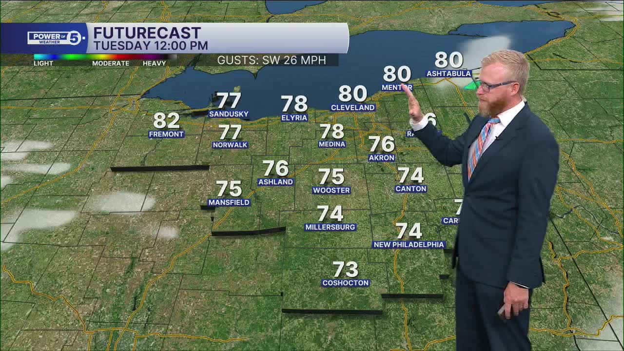
Then it gets hot and gusty fast.
Winds could gust to around 30 mph this afternoon, helping temps soar into the middle 80s. The record high for Cleveland is 82°, and we’re forecasting a high closer to 85°. This is a one-day burst of big October heat.
Several records are in jeopardy on Tuesday...
- Cleveland: Current record is 82º, set back in 1969.
- Akron/Canton: Current record is 82º, set back in 1969.
- Mansfield: Current record is 84º, set back in 1969
Stormy Wednesday morning
A much different day arrives Wednesday. Scattered rain and storms will move through during the morning, and a few could be strong with heavy rain, gusty winds and occasional lightning.
Give yourself some extra time for the morning commute. Heavy downpours could briefly make it tough to see on the roads. For kids heading to the bus stop or school, keep the rain gear handy and have a way to get indoors quickly if you hear thunder.
Temps won’t move much Wednesday, holding in the 60s through the day.
Cooler pattern takes over
We’ll get a break before another round of rain moves in Thursday evening. Showers are likely again Friday as even cooler air settles into Northeast Ohio.
So enjoy today’s warmth if you’re a fan. The mid-80s won’t stick around.
Power of 5 Highlighted Region: West Region
The West Region gets the biggest taste of today’s October heat.
Southwest winds will be stronger here, with gusts around 30 mph. The flatter terrain also does less to slow that wind down. More wind means more heat, helping temps soar into the middle 80s this afternoon.
5-Day Forecast:
Monday: Drying out, warming up.| High: 74º
Tuesday: Few AM T-Showers then warm & windy. | High: 83º
Wednesday: Mostly cloudy. Rain possible. Breezy & cooler. | High: 69º
Thursday: Rain possible late, potential impacts to ALCS Game 3. Colder. | High: 64º
Friday: Few showers. Cooler again. | High: 59º
Learn the lingo: The Power of 5 Weather Team wants to get you your forecast closer to home. We have broken NEO into 5 separate and distinct regions. Find your region to get your hyper-local forecast!
- Cleveland Metro Region: Cuyahoga County. This region includes cities such as Cleveland, Parma, Westlake, Berea, Strongsville, Independence, Solon, Beachwood, and Euclid.
- Snowbelt Region: Lake, Geauga, and Ashtabula Counties. This includes cities such as Mentor, Geneva, Ashtabula, Bainbridge, Chardon, Burton, and Orwell.
- Akron-Canton Region: Summit, Stark, and Portage Counties. This region includes cities such as Akron, Canton, Hudson, Ravenna, Mantua, Alliance, and Canal Fulton.
- West Region: Lorain, Medina, Erie, Huron, Richland, and Ashland Counties. This region includes cities such as Lorain, Wellington, Medina, Lodi, Ashland, Mansfield, Willard, and Sandusky.
- South Region: Wayne, Holmes, Tuscarawas, Carroll Counties. This region includes Wooster, Millersburg, New Philadelphia, Strasburg, Mineral City, Carrollton, and Newcomerstown
You can send us photos and short videos by filling out the form below:
Want the latest Power of 5 weather team updates wherever you go? Download the News 5 App free now: Apple|Android
Click here to view our interactive radar.
Follow the News 5 Weather Team:
Trent Magill: Facebook & Twitter
Katie McGraw: Facebook & Twitter
Phil Sakal: Facebook & Twitter
Allan Nosoff: Facebook & Twitter
