


CLEVELAND — Last night's snow showers are a distant memory, or not a memory at all for those south of Akron. A quick coating to an inch in spots could cause some slick spots, especially on untreated side streets. Otherwise, it's another freezing cold day with some peeks of sunshine into the afternoon. Today will be the last below-freezing day of this week-long stretch.
Another snow shower can't completely be ruled out tonight right along the lakeshore, but the clipper is expected to stay safely to the north. The storm track is shifting north, introducing a warm-up into the workweek.
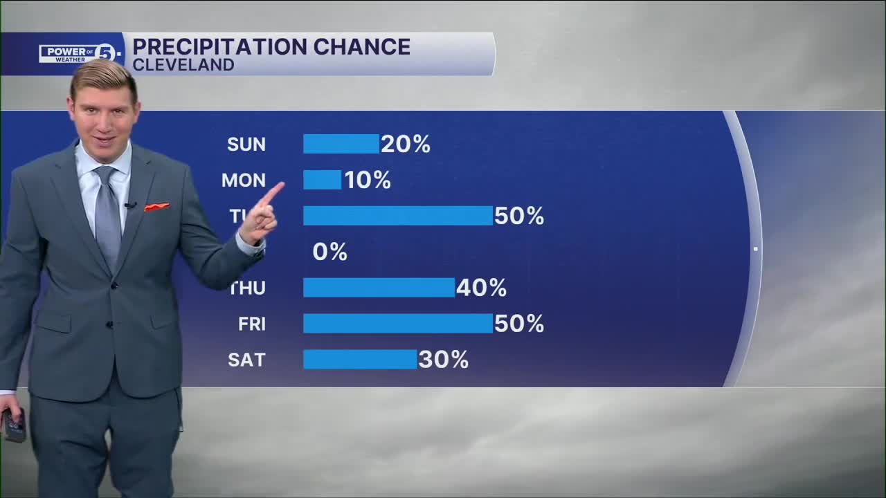
It will be above freezing Monday with highs in the upper 30s. The 40s arrive on Tuesday with some rain likely, especially during the evening. 50s for highs likely on Thursday, but it comes with rain, as do most warm-ups this time of year. 60 degrees is now possible on Friday with an extra surge of warmth ahead of a weekend cold shot, again.
DAILY FORECAST:
Today: Mostly cloudy. Cold. | High: 27º
Monday: Stray morning snow shower, otherwise mostly sunny and warmer. | High: 37º
Tuesday: Cloudy but milder with a few PM rain showers. | High: 45º
Wednesday: Mostly cloudy. | High: 45º
Thursday: Rain possible. Warmer. | High: 55º
Friday: Rain possible. Warm. | High: 60º
Want the latest Power of 5 weather team updates wherever you go? Download the News 5 App free now: Apple|Android
Click here to view our interactive radar.
Follow the News 5 Weather Team:
Trent Magill: Facebook & Twitter
Katie McGraw: Facebook & Twitter
Phil Sakal: Facebook & Twitter
Allan Nosoff: Facebook & Twitter
