


CLEVELAND — A windy wintry mess will be possible to start off your mid-week. Most of the mess will begin to move into the region during the early morning hours on Wednesday.
It's all dependent on a degree warmer or colder. That being said. Plan for winds gusting to 40 mph, heavy rain, and heavy snow. It'll be a mix of both. More snow in spots that stay colder. More rain in spots that manage to warm up.
Plan on wet and/or snow-covered roads during the Wednesday morning commute.
The bulk of the moisture is gone after the AM drive. We'll hold the middle and upper 30s until lunchtime, then a cold front passes and temps take a dive. We're dropping into the 20s by sunset for most. That means wet roads will freeze overnight with additional snow for some.
Lake effect will be the trend on Thursday and again on Friday. Brutally cold coming back as we wrap up the week. More widespread snow will be possible on Saturday, with highs in the 20s. Coldest air of the season settles in for Sunday, along with a few snow showers. Highs might not even reach 20° for the first time since the end of February.
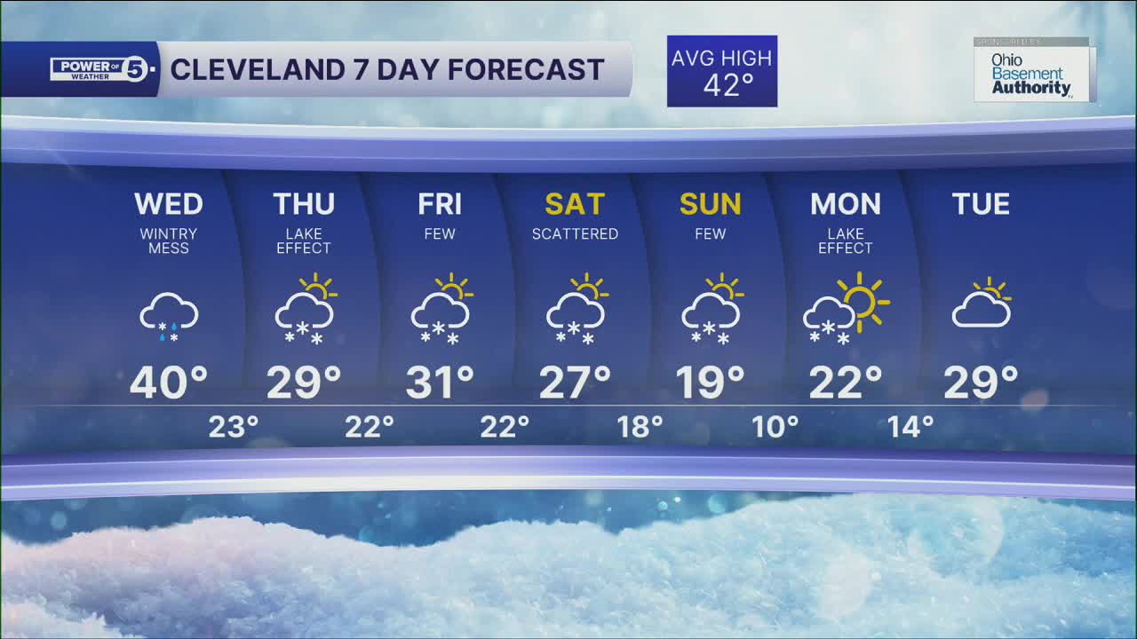
DAILY FORECAST:
Wednesday: AM Scattered rain/snow mix. PM Scattered snow showers. Windy. | High: 40º (Midday)
Thursday: Cold with a few lake effect snow showers. | High: 30º
Friday: Cold with a few snow showers. | High: 29º
Saturday: Cold with lake effect snow showers possible. | High: 25º
Want the latest Power of 5 weather team updates wherever you go? Download the News 5 App free now: Apple|Android
Click here to view our interactive radar.
Follow the News 5 Weather Team:
Trent Magill: Facebook & Twitter
Katie McGraw: Facebook & Twitter
Phil Sakal: Facebook & Twitter
Allan Nosoff: Facebook & Twitter
