


CLEVELAND — There is no rain in the forecast until the end of the week, with rain possible on Friday and becoming more likely by next Saturday. That means your spring and/or outdoor plans will be good to go. Lots of sunshine and low humidity are here to stay.
With the sunshine, make sure to protect your skin as the UV index will be at 9 into early next week as we get closer and closer to the Summer Solstice, as the sun angle appoaches it's highest for the year!
Anticipate grabbing a spring jacket if you are out and about early on Sunday, as many areas will start off the second half of the weekend in the mid to upper 40s under mostly clear skies.
Less wind and more sunshine will lead to warmer temperatures, as highs climb back into the 70s for the second half of your Sunday. BUT, the shoreline communities will see the high on Sunday around midday. A lake breeze will cool things down once again by the mid to late afternoon on Sunday, especially from Cleveland towards the Pennsylvania border.
For all my summer and heat lovers, the hot and humid days will come! For now, enjoy the cool mornings and comfortable afternoons and save on the a/c bill! Temperatures will gradually warm by mid to late next week, as rain chances return by Friday or Saturday. Stay Tuned!
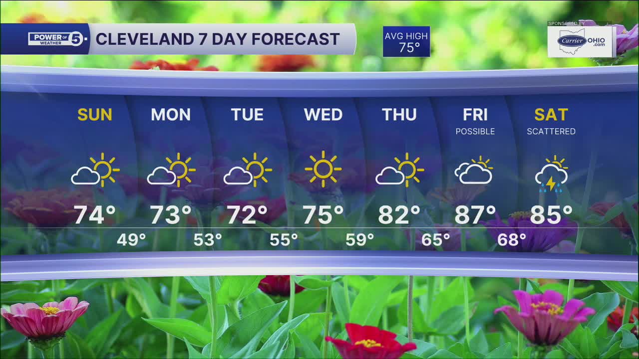
DAILY FORECAST:
Sunday: Sunny and warmer.| High: 74º
Monday: A few clouds. A touch below average.| High: 73º
Tuesday: Mostly sunny and comfortable.| High: 72º
Wednesday: Mostly sunny and comfortable.| High: 75º
Thursday: Mostly sunny and warmer.| High: 82º
Friday: More clouds. Warmer & muggy. Rain possible.| High: 87º
Saturday: Scattered rain and storms. Warm & muggy.| High: 85º
Want the latest Power of 5 weather team updates wherever you go? Download the News 5 App free now: Apple|Android
Click here to view our interactive radar.
Follow the News 5 Weather Team:
Trent Magill: Facebook & Twitter
Katie McGraw: Facebook & Twitter
Phil Sakal: Facebook & Twitter
Allan Nosoff: Facebook & Twitter
