


CLEVELAND — 1 to 3 inches of snow is expected across most of Northeast Ohio before a changeover to a mix then rain by Sunday morning. That will cause some melting and compacting of totals, plus the lake effect accumulations from Thursday and Friday will make measuring the snow properly difficult.
It should dry up by kickoff for the Browns as they face the 49ers, but there could be some scattered lake effect snow showers returning towards the end of the game. And then more snow next week! Monday night into Tuesday could bring a few more inches of snow as a major nor'easter could develop off the Northeast coast.
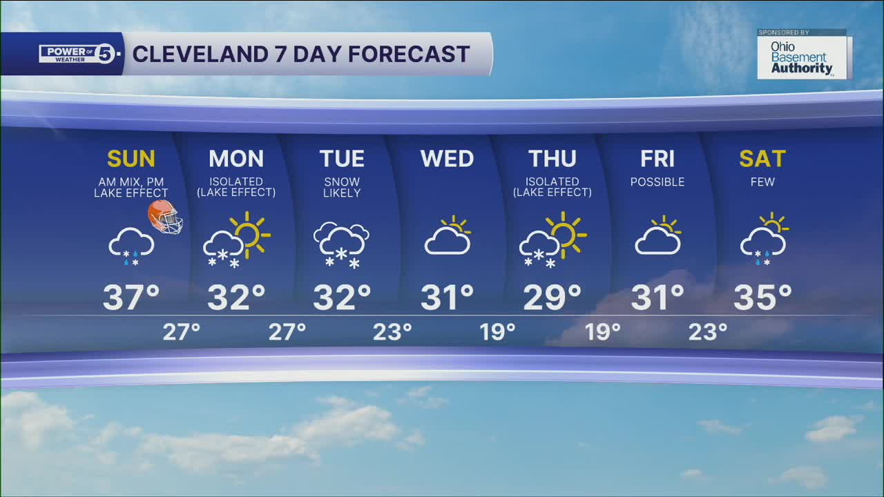
DAILY FORECAST:
Sunday: Snow changes over to rain and tapers midday. Lake effect snow showers at night. | High: 37º
Monday: Cloudy & Cold. Isolated lake-effect snow. | High: 32º
Tuesday: More snow. Accumulations possible. | High: 32º
Wednesday: Mostly Cloudy & Cold. | High: 31º
Thursday: Cloudy & Cold. Isolated lake-effect snow. | High: 29º
Friday: Cloudy & Cold. Few snow showers. | High: 31º
Want the latest Power of 5 weather team updates wherever you go? Download the News 5 App free now: Apple|Android
Click here to view our interactive radar.
Follow the News 5 Weather Team:
Trent Magill: Facebook & Twitter
Katie McGraw: Facebook & Twitter
Phil Sakal: Facebook & Twitter
Allan Nosoff: Facebook & Twitter
