


CLEVELAND — Temperatures will be close to 32° to start your weekend, with temperatures in the mid-to-upper 30s by Saturday afternoon. The second half of the weekend will be much more active.
A warm front moves in by Sunday morning, and rain showers will move into the region along with the warm front. Temperatures will soar into the 50s and 60s by Sunday afternoon, along with windy conditions. Wind gusts of 40 to 50 mph will be possible Sunday afternoon and night. A cold front will then push through during the second half of the evening through the wee hours of Monday morning. The cold front could bring isolated strong to severe storms, with damaging winds and heavy rain.
Behind the cold front we will have a temperature tumble to end 2025. Rain to Rain/Snow to Snow showers by late Sunday night into Monday morning, as temperatures drop through the 40s early Monday into the 20s by the mid to late morning on Monday.
Snow chances will linger for the end of 2025, as a series of clippers will be possible, along with temperatures only in the 20s through New Year's Eve. So if you plan on ringing in 2026, you'll need to bundle up!
Temperatures remain well below average to begin 2026, along with snow chances New Year's Day through Friday.
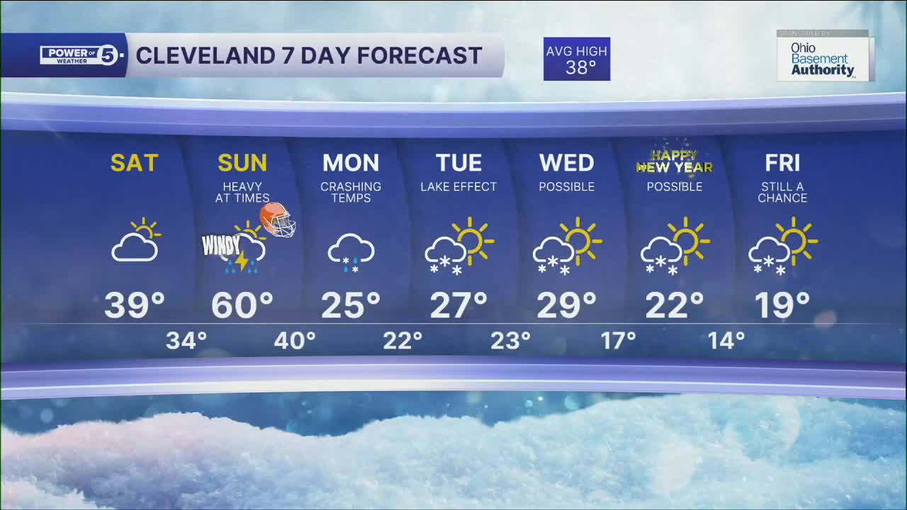
DAILY FORECAST:
Saturday: Cool & dry. Mostly cloudy. | High: 36º
Sunday: Scattered showers and a few strong t-storms possible. Windy & warm. | High: 60º
Monday: Temperatures Tumble. Lake effect snow possible. | High: 25º
Tuesday: Breezy & cold. Lake effect snow possible. | High: 27º
New Year's Eve: Cold. Lake effect snow possible. | High: 29º
New Year's Day: Cold to start 2026. Lake effect snow possible. | High: 22º
Friday: Even colder. Lake effect snow possible. | High: 19º
Want the latest Power of 5 weather team updates wherever you go? Download the News 5 App free now: Apple|Android
Click here to view our interactive radar.
Follow the News 5 Weather Team:
Trent Magill: Facebook & Twitter
Katie McGraw: Facebook & Twitter
Phil Sakal: Facebook & Twitter
Allan Nosoff: Facebook & Twitter
