



CLEVELAND —
Showers returning tonight & tomorrow...
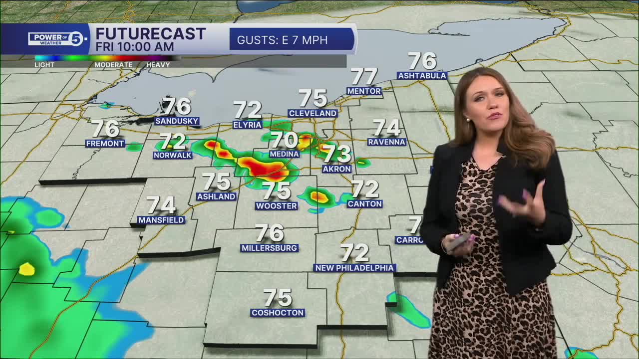
Rain is returning this evening, mainly across the West and South Regions. Most of it should be light to steady, so your plans can continue with only a few interruptions. Rain coverage increases overnight as a stronger batch moves in ahead of Friday morning's commute, again for the same regions, but the intensity could pick up with downpours possible. Keep in mind, while the best chance for rain over the next day is to the southwest, a couple of showers and downpours will still be possible across all of NEO. The SW trend is true not only across our viewing area but for the whole state. SW Ohio, such as Dayton and Cincinnati, has a much better chance for rain, storms, and severe weather compared to us across NEO.
Expect a wetter start to Friday with periods of scattered rain, a few downpours, and even some lightning. If you're heading out early, allow extra time and keep an eye out for ponding on roads. It is NOT a 100% chance of rain. It will be a feast or famine when it comes to rainfall amounts. Some communities could pick up a quick half an inch to one inch of rain. And others will stay dry all day.
The good news: rain tapers off by Friday afternoon, and we're set up for a dry stretch through Saturday afternoon.
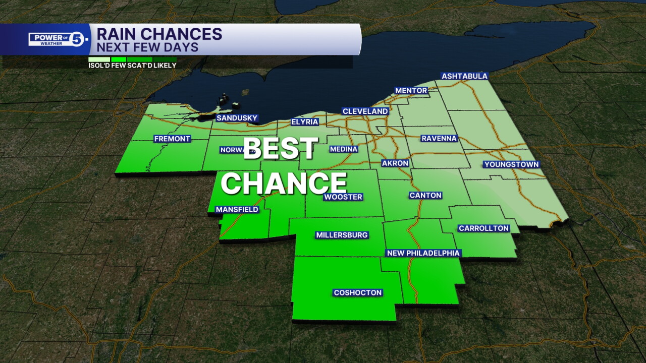
Power of 5 Regions Spotlight: West and South Regions
Mother Nature tends to stick to the same areas receiving the most weather whenever there is a consistent weather pattern, in this case a rainy one. The West and South Regions have the best chance to pick up additional rain this evening, starting in the west and spreading farther south by Friday. Most of the rain will be on the lighter side at first, but showers become more widespread overnight and could bring pockets of heavier rain by Friday morning. If you have evening outdoor plans, keep the umbrella handy and stay weather aware heading into the overnight hours.
Looking ahead...
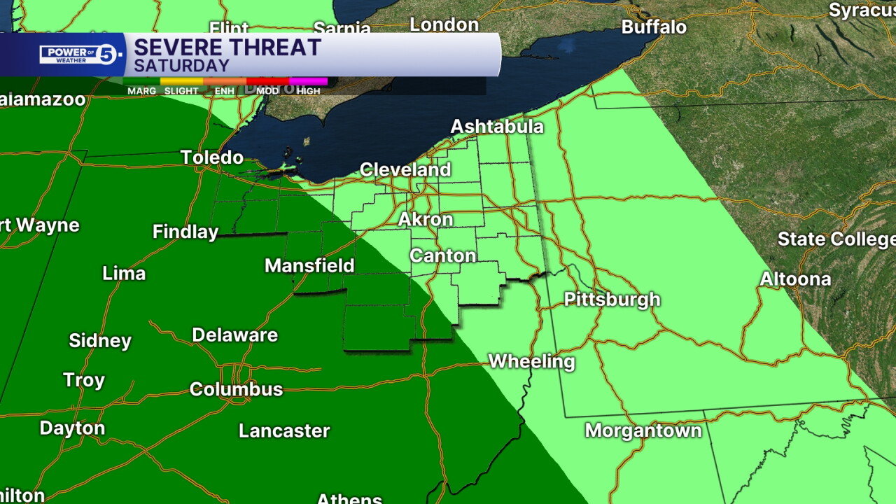
The weekend looks to start dry. Just like Friday, the best chance for late afternoon and evening storms will be in our south and west regions. There is even a risk posted for the potential of severe weather on Saturday. That darker green is a level 1 out of 5 and means there is a chance for a couple of strong or severe storms. We will keep you posted on this potential. On Sunday, it looks like there could be some morning showers, a dry afternoon with more storms in the evening...that once again could pack a punch with damaging storms. Stay alert this weekend!
5-Day Forecast
Thursday Night: Late evening showers, especially S&W. | Low: 67º
Friday: A few t-showers, especially south, mainly AM.| High: 81º
Saturday: Isolated PM t-showers. Mostly cloudy. | High: 83º
Sunday: AM showers. Severe storms possible later. Hot and humid. | High: 87º
Monday: A Few t-showers. Much cooler. | High: 77º
Learn the lingo: The Power of 5 Weather Team wants to get you your forecast closer to home. We have broken NEO into 5 separate and distinct regions. Find your region to get your hyper-local forecast!
- Cleveland Metro Region: Cuyahoga County. This region includes cities such as Cleveland, Parma, Westlake, Berea, Strongsville, Independence, Solon, Beachwood and Euclid.
- Snowbelt Region: Lake, Geauga and Ashtabula Counties. This includes cities such as Mentor, Geneva, Ashtabula, Bainbridge, Chardon, Burton and Orwell.
- Akron-Canton Region: Summit, Stark and Portage Counties. This region includes cities such as Akron, Canton, Hudson, Ravenna, Mantua, Alliance, and Canal Fulton.
- West Region: Lorain, Medina, Erie, Huron, Richland and Ashland Counties. This region includes cities such as Lorain, Wellington, Medina, Lodi, Ashland, Mansfield, Willard, and Sandusky.
- South Region: Wayne, Holmes, Tuscarawas, Carroll Counties. This region includes Wooster, Millersburg, New Philadelphia, Strasburg, Mineral City, Carrollton, and Newcomerstown
Want the latest Power of 5 weather team updates wherever you go? Download the News 5 App free now: Apple|Android
Click here to view our interactive radar.
Follow the News 5 Weather Team:
Trent Magill: Facebook & Twitter
Katie McGraw: Facebook & Twitter
Phil Sakal: Facebook & Twitter
Allan Nosoff: Facebook & Twitter
