


CLEVELAND — First the clouds, then the rain. Two systems will impact NEO over the next day. One to the south and a cold front to the north.
The first system to the south will bring showers this evening. Rain will start in our southern communities and will continue overnight and into early Wednesday. The overcast sky will keep our temperatures mild overnight with lows in the 60s.
Showers will gradually pull farther north by the early afternoon, but this is not a 100% chance for rain. As a rule, there is a much better chance of rain the farther south you live. Sporadic downpours and random rumbles of thunder are possible.
The cold front to the north has a lot less moisture, but a couple more showers will be possible as the front moves through. The greater impact from the front will be a change in wind direction (from the south to the north), and it will get a bit breezier by Thursday.
The front will also drop our temperatures for the end of the week and into the weekend. It will be slightly below average, but still pleasant. Plus, it looks dry for several days! Drier than normal conditions could continue until early June!
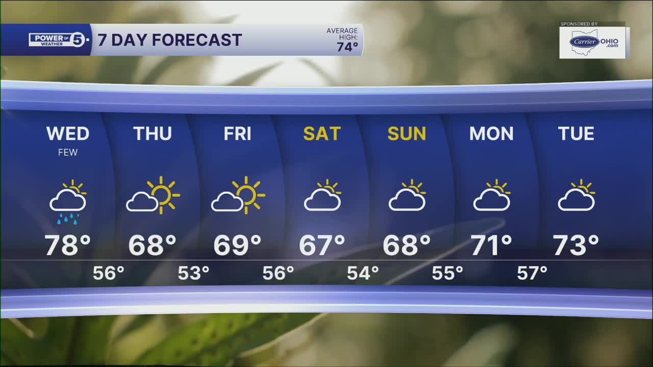
DAILY FORECAST:
Tonight: More clouds. Few showers, especially south.| Low: 60º
Wednesday: Showers possible. Warm.| High: 78º
Thursday: Cooler. Looking dry.| High: 68º
Friday: Partly cloudy. Seasonable.| High: 69º
Saturday: Partly cloudy. Seasonable.| High: 67º
Sunday: Partly cloudy. Seasonable.| High: 68º
Want the latest Power of 5 weather team updates wherever you go? Download the News 5 App free now: Apple|Android
Click here to view our interactive radar.
Follow the News 5 Weather Team:
Trent Magill: Facebook & Twitter
Katie McGraw: Facebook & Twitter
Phil Sakal: Facebook & Twitter
Allan Nosoff: Facebook & Twitter
