


CLEVELAND — A few showers quickly raced across Northeast Ohio before sunrise Saturday, and the rest of the evening will be mostly dry. An area of low pressure is sinking south through the day and will transfer its energy to a rapidly-strengthening nor'easter off the southeast coast.
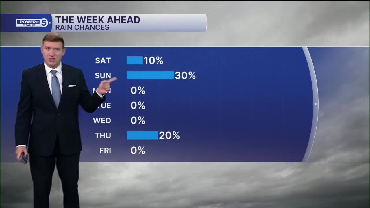
While the massive nor'easter will track offshore and impact the East Coast, the outer fringes of the storm may clip Northeast Ohio. A few passing showers are possible, about a 30 percent chance, on Sunday. and continue into tomorrow. The extra clouds will prevent our temperatures from reaching 70 degrees on Saturday, but at the same time will prevent temperatures from dropping as much tonight. It will be mostly in the 50s and upper 40s inland.
The best chance for those showers Sunday will be east of I-77, with an even better chance once you cross state lines into PA. In fact, a few showers are possible for the Browns game in Pittsburgh. This is all due to the strong nor'easter. It will also be a bit breezier with some 20 to 30 mile-per-hour gusts.
Rain chances return to zero for the first half of the work week with seasonable temperatures in the 60s.
DAILY FORECAST:
Today: More clouds. A stray shower chance. | High: 65º
Tonight: Mostly cloudy. | High: 52º
Sunday: More clouds. Few showers, mainly east. | High: 68º
Monday: Brightening sky, mild for October. | High: 70º
Want the latest Power of 5 weather team updates wherever you go? Download the News 5 App free now: Apple|Android
Click here to view our interactive radar.
Follow the News 5 Weather Team:
Trent Magill: Facebook & Twitter
Katie McGraw: Facebook & Twitter
Phil Sakal: Facebook & Twitter
Allan Nosoff: Facebook & Twitter
