


CLEVELAND — Dust off the heavier jackets and coats, we're staying BELOW average for the next few days. As high pressure builds into NEO following Tuesday's cold front, clear skies, calmer winds, and cooler temperatures could lead to frost development tonight and tomorrow night. A frost advisory has been issued for Ashtabula County tonight, but it looks even colder Thursday night/Friday morning.
Lows will fall into the 30s and 40s for both Thursday and Friday morning. Patchy frost is expected tonight, but it looks even colder on Friday. Some inland communities could get as low as the low 30s! This means frost will be more widespread, and a freeze could even be possible for some.
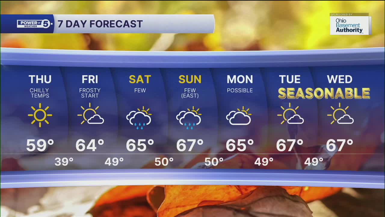
Afternoon temperatures will slowly rise by this weekend, and it will be very typical for October with highs in the mid and upper 60s. There will be plenty of dry time this weekend, but the latest data suggests a few showers cannot be ruled out on both Saturday and Sunday, particularly late Saturday and in our eastern communities on Sunday. It is still several days out, so we will be sure to keep you posted on the likelihood of these showers and potential impacts to your plans.
DAILY FORECAST:
Wednesday Night: Chilly temperatures, clear skies. Patchy frost. | Low: 44º
Thursday: Bright but still cool. | High: 58º
Friday: Seasonable.| High: 64º
Saturday: More clouds. A few PM showers. | High: 65º
Sunday: More clouds. Few showers, mainly east. | High: 67º
Want the latest Power of 5 weather team updates wherever you go? Download the News 5 App free now: Apple|Android
Click here to view our interactive radar.
Follow the News 5 Weather Team:
Trent Magill: Facebook & Twitter
Katie McGraw: Facebook & Twitter
Phil Sakal: Facebook & Twitter
Allan Nosoff: Facebook & Twitter
