


CLEVELAND — Super sunny again today. Low humidity, Temps in the upper 70s. Beautiful Wednesday.
Clouds return this evening and eventually lead to better rain chances. It starts tonight. Plan on a few fading storms around midnight with showers lingering until the AM commute. Thursday won't be a washout but we still need to be on alert. Especially for the afternoon.
Humidity building and fueling thunderstorms along with peak daytime heating. Most of us get rain and thunder but only isolated areas get damage. The threat is low but not-zero. So be alert.
Another round of scattered storms in the forecast to wrap up the week and start of the weekend, as another area of low pressure moves into Ohio.
Then once we head into next week, the heat begins to build! Upper 80s and lower 90s are looking more possible by Monday through the middle of next week, along with much more noticeable humidity.
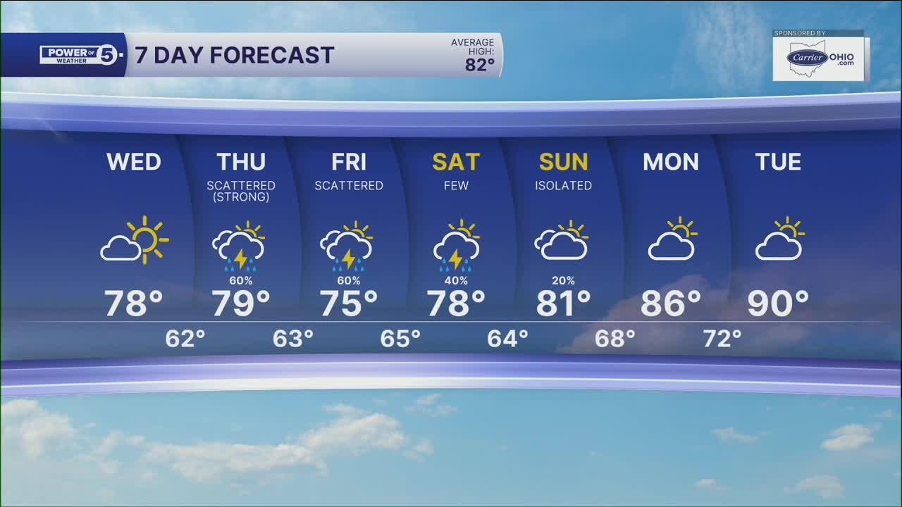
DAILY FORECAST:
Wednesday: Bright & still comfortable. Touch warmer. High: 78º
Thursday: Morning rain, afternoon thunderstorms. High: 79º
Friday: Scattered thunderstorms. High: 75º
Saturday: Scattered storms. Muggy. High: 78º
Sunday: Isolated rain. More seasonable. Muggy. High: 81º
Monday: Possible storm. Warmer and muggy. High: 86º
Tuesday: Isolated storms. Hot & humid. High: 90º
Want the latest Power of 5 weather team updates wherever you go? Download the News 5 App free now: Apple|Android
Click here to view our interactive radar.
Follow the News 5 Weather Team:
Trent Magill: Facebook & Twitter
Katie McGraw: Facebook & Twitter
Phil Sakal: Facebook & Twitter
Allan Nosoff: Facebook & Twitter
