


CLEVELAND — One more hurdle before we're off to an INCREDIBLE Labor Day weekend, and that is the storms that are moving through NEO as I type! The storms will continue to sink south and weaken after midnight. A few lingering, lighter showers are expected on Friday, especially during the first half of the day.
A gradual clearing and drying trend is expected throughout the day on Friday. It remains chilly, though! Highs will only be in the 60s tomorrow, so be sure to grab an extra layer for any Friday evening plans you have, as temperatures will dip into the low 50s and upper 40s Friday night and into Saturday.
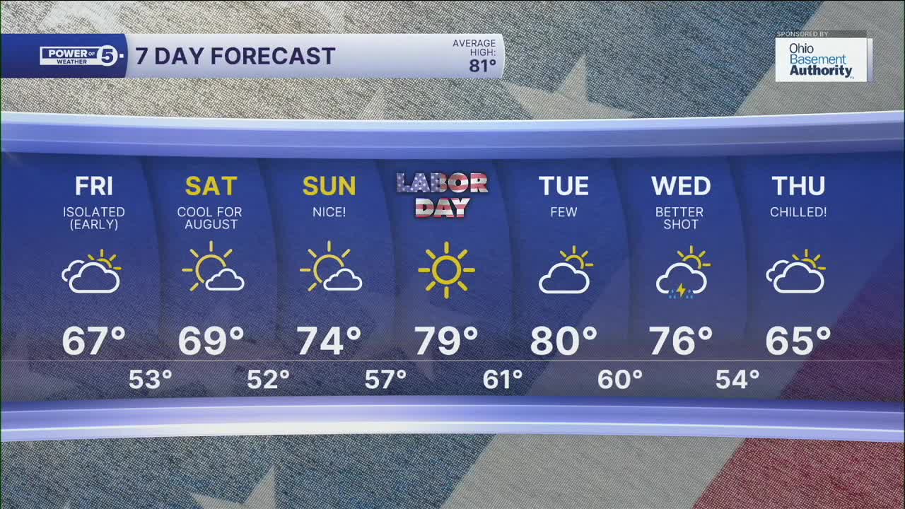
The holiday weekend will start chilly, with temperatures 10 degrees below average, but a gradual warming trend is expected. Plan for upper 60s/low 70s on Friday and Saturday, mid to upper 70s on Sunday, and upper 70s to low 80s by Labor Day! You should be able to get in one more visit to the area pools before they close after LDW.
Another powerful cold front is expected to take aim at our region next week. Storms are most likely on Wednesday. Following the storms, temperatures will crash again by the end of next week's work week.
DAILY FORECAST:
Thursday Night: Storms fade. Cool. | Low: 56º
Friday: Isolated showers early. Cooler. | High: 66º
Saturday: Partly sunny. Touch warmer. | High: 69º
Sunday: More sunshine. Still below average. | High: 74º
Labor Day: A Bit milder, still dry. | High: 79º
Tuesday: Near norm. Few storms. | High: 80º
Want the latest Power of 5 weather team updates wherever you go? Download the News 5 App free now: Apple|Android
Click here to view our interactive radar.
Follow the News 5 Weather Team:
Trent Magill: Facebook & Twitter
Katie McGraw: Facebook & Twitter
Phil Sakal: Facebook & Twitter
Allan Nosoff: Facebook & Twitter
