


CLEVELAND — Temps are in the mid-90s, heat index readings in the triple digits. Extreme heat warnings remain in effect until 8 p.m. on Friday. That is because it is dangerous for young kids, the elderly, and pets. Make sure we're all taking breaks, staying cool, and finding ways to keep our loved ones cool.
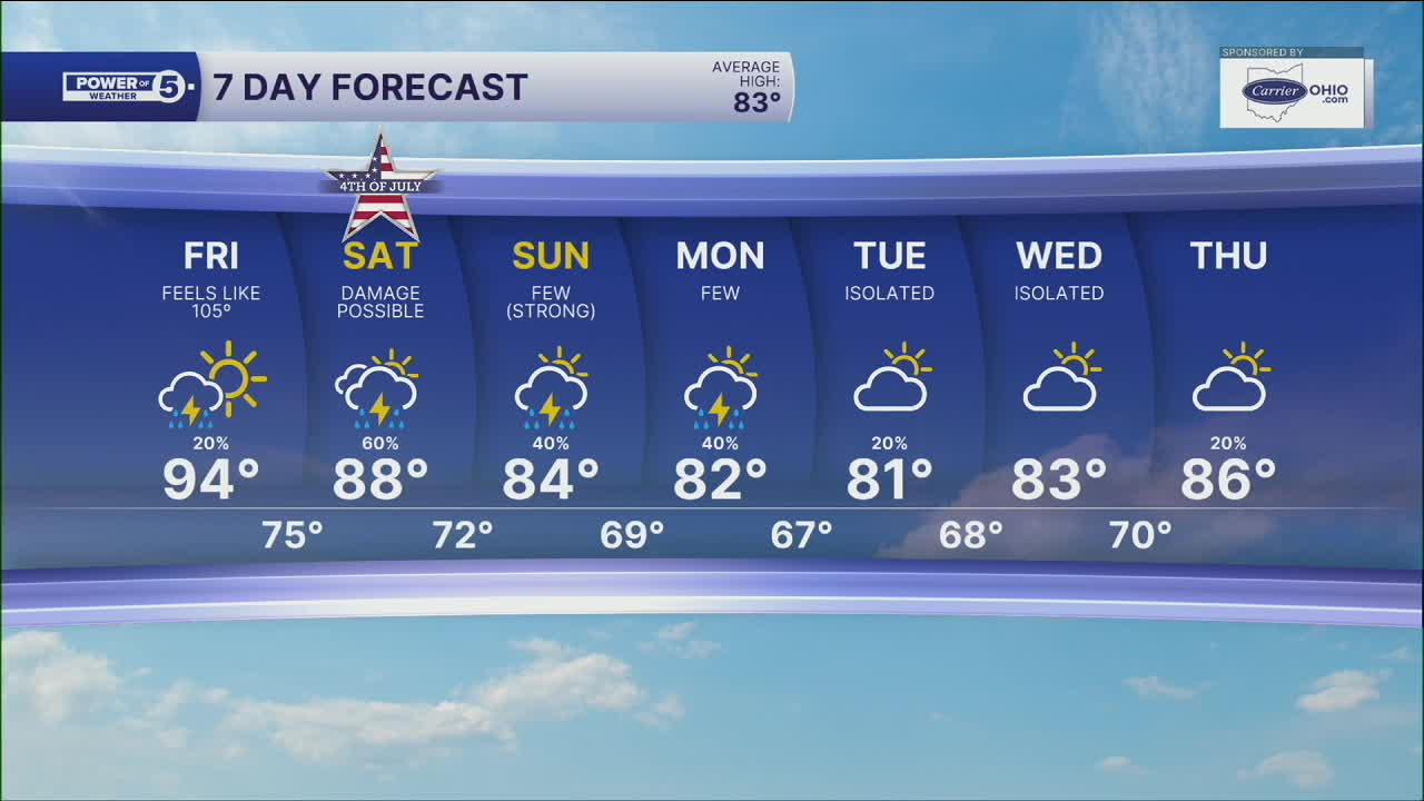
The heat wave is coming to an end. But as that happens, the chances of storms will ramp up. Storm chances start to return on Friday. While storms look pretty isolated, any storm could pack a punch with damaging winds, heavy rain, and lightning.
Even more storms are heading our way this weekend. Your Fourth of July *fourth*cast is steamy and stormy! Plan on more thunderstorms than Friday, but it does not look to rain all day, nor is it a guarantee for wet weather. Once again, storms could become strong or severe.
The increase in storm chances will decrease our temperatures by next week. It will still be warm and summery, but highs in the low to mid 80s are expected.
DAILY FORECAST:
Friday: Still Hot. Isolated storms. |High: 95º, feels like 100º-105º
4th of July: Few storms, could be severe. Still hot & humid. | High: 91º, feels like 95º-100º
Sunday: A few storms. Could be strong | High: 86º
Monday: A few more storms. Not as hot. | High: 82º
Tuesday: Isolated thunder but still more seasonable. | High: 82º
Want the latest Power of 5 weather team updates wherever you go? Download the News 5 App free now: Apple|Android
Click here to view our interactive radar.
Follow the News 5 Weather Team:
Trent Magill: Facebook & Twitter
Katie McGraw: Facebook & Twitter
Phil Sakal: Facebook & Twitter
Allan Nosoff: Facebook & Twitter
