


CLEVELAND — If you are hoping for some relief from the heat...you are in luck!
A cold front is approaching, bringing thunderstorms and MUCH cooler air. Those storms are moving into western Ohio tonight and will continue to spread out to the east overnight and farther south early on Thursday. We will be watching for any strong or severe storms as the front slides through NEO. The flood threat will be the main concern with rounds of heavy rain into tomorrow.
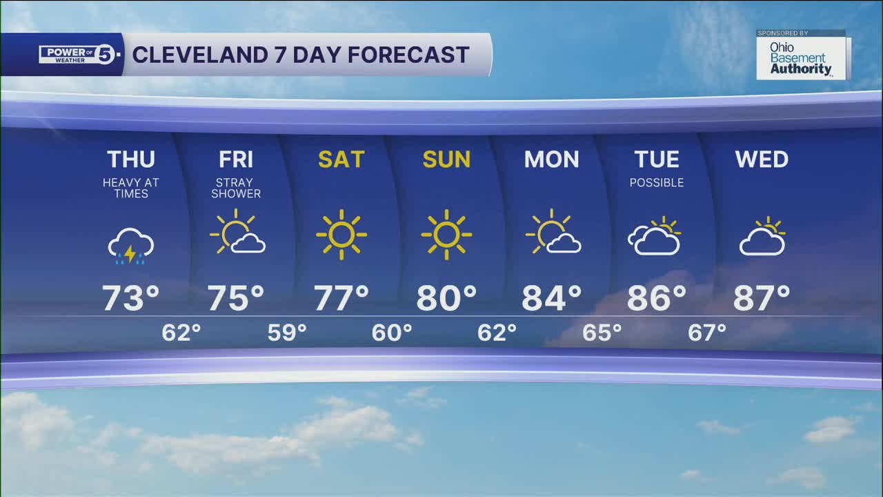
The best chance for rain and storms this week is on Thursday. It honestly is looking very wet tomorrow, especially in our northern communities, and during the morning and afternoon. Rain looks to taper off by Thursday evening. For a more in-depth look at the forecast for tomorrow...click this link.
The cold front will live up to its name, bringing significantly cooler, more comfortable air by the end of next week and continuing into the weekend. The weekend looks FANTASTIC - dry, not too hot or humid!
DAILY FORECAST:
Wednesday Night: Rain and storms return. | Low: 75º
Thursday: Widespread thunderstorms with rounds of heavy rain elevating our flood threat. | High: 75º falling into the upper 60s
Friday: Drying quickly, comfortable humidity. | High: 75º
Saturday: Sunny and pleasant. | High: 77º
Sunday: Sunny & Mild. | High: 80º
Download the News 5 app for the latest weather updates:
Follow the News 5 Weather Team:
Trent Magill: Facebook & Twitter
Katie McGraw: Facebook & Twitter
Phil Sakal: Facebook & Twitter
