


CLEVELAND — Get ready to sweat!! The heat wave starts today!
A "Heat Wave" is a technical term. To call a stretch of heat a "heat wave" here in NEO you need 3 consecutive 90º days. We had one heat wave last year. We average 1 per year. We'll get our first one this week. And we won't stop at just 3-days.
A major heat dome begins to build over the Ohio Valley this week. Temps surging to near 90 degrees on Monday and into the middle 90s on Tuesday. Much more noticeable humidity also arrives alongside the heat. High heat + high humidity = dangerous heat. It will feel like triple digits for at least three straight days, something Northeast Ohio does not see often in any given summer.
Better rain chances look to return by the holiday weekend, unfortunately. It is still too soon to talk specifics, but we will keep you posted about impacts to Fourth of July plans!
DAILY FORECAST:
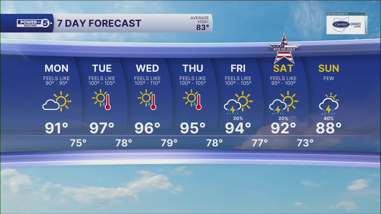
Monday: Mostly sunny, hot, and more humid. High: 91º, feels like 90-95º
Tuesday: Sunny. Hazy, hot & humid. High: 97º, feels like 100-105º
Wednesday: Sunny. Hazy, hot & humid. Record possible. High: 96º, feels like 105-110º
Thursday: Sunny. Hazy, hot & humid. High: 95º, feels like 100-105º
Friday: Still Hot. High: 94º, feels like 100º-105º
Want the latest Power of 5 weather team updates wherever you go? Download the News 5 App free now: Apple|Android
Click here to view our interactive radar.
Follow the News 5 Weather Team:
Trent Magill: Facebook & Twitter
Katie McGraw: Facebook & Twitter
Phil Sakal: Facebook & Twitter
Allan Nosoff: Facebook & Twitter
