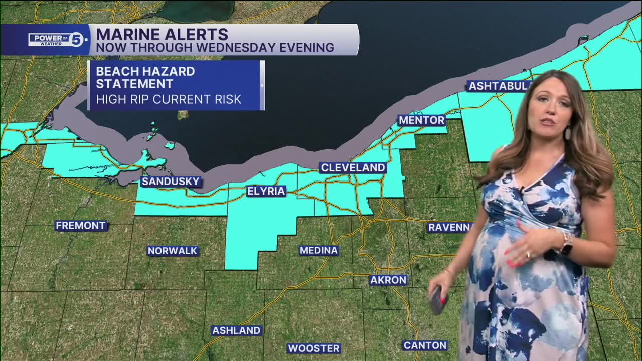


CLEVELAND — It's layers season! A sweatshirt is a good idea tonight and into the early hours of tomorrow. It will be mostly clear and cool with highs in the upper 40s and low 50s. It will remain breezy as well with NE winds 10-15 mph and gusts up to 30 mph. The gusty winds will make Lake Erie dangerous tonight into tomorrow. Waves could be as high as 4 to 8 feet!
The stronger winds are thanks to a cold front moving through NEO. This is a dry front, though, so rain chances remain zero. However, there will be cooler temperatures on Wednesday, and highs will be about 5-10 degrees cooler, with highs in the low to mid 70s, which is a bit more typical this time of year.
The seasonable temperatures are short-lived, though! Temperatures get a boost by the end of the week. 80s look likely by this weekend! HOTober!
Rain chances appear to be on hold for the next week, so you'll need to keep the plants watered once again. September ended up below average for all of NEO. In Cleveland, it was the sixth driest September ever, with only 0.75 inches of rain at Cleveland Hopkins Airport. The current streak of dry days is 5 days, and that will likely grow to 9 or 10 at minimum with the next chance for rain holding off until Tuesday or maybe even Wednesday...of NEXT week.
DAILY FORECAST:
Tuesday Night: Clear, cool, and breezy. | Low: 52º
Wednesday: More seasonable but still bright. | High: 70º
Thursday: Bright & seasonable. | High: 72º
Friday: Heating up... | High: 75º
Saturday: Bright & hot (for October) | High: 80º
Want the latest Power of 5 weather team updates wherever you go? Download the News 5 App free now: Apple|Android
Click here to view our interactive radar.
Follow the News 5 Weather Team:
Trent Magill: Facebook & Twitter
Katie McGraw: Facebook & Twitter
Phil Sakal: Facebook & Twitter
Allan Nosoff: Facebook & Twitter
