


CLEVELAND — The worst of the rain and storms have passed, but we are NOT done with the rain.
A few isolated storms are possible tonight, but most communities will stay dry. After a sunny and dry start to the day on Friday, there will be an increase in clouds by the late morning and early afternoon. Then, a few t-showers are expected for a few hours in the afternoon and evening. These will be hit or miss, but there is STILL a chance for wet weather for the first day of summer.
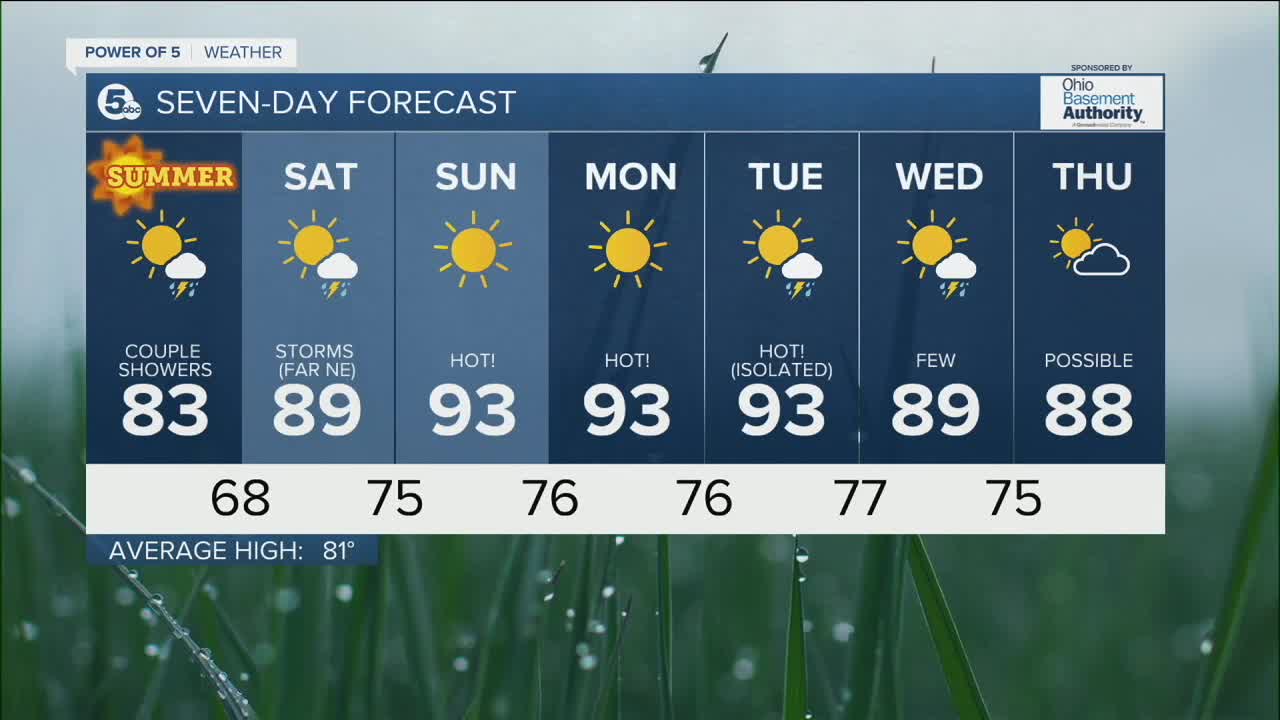
A huge ridge of high pressure will build in over the weekend, and we HEAT up quick - hello to our 1st heat wave of the season!! 90s for high temps, with heat index values well into the 90s, to perhaps 100 - 105! Much of the area will be dry all weekend, but a few storms are possible in our far NE communities on Saturday. As the ridge gets stronger, rain chances drop for everyone on Sunday.
Stay cool!
DAILY FORECAST:
Thursday Night: Mostly clear. Stray storms.| Low: 60º
Friday: Seasonal with mostly sunny skies. Summer starts! | High: 83º
Saturday: Staying dry and heating up! | High: 89º
Sunday: Sunny. Hot! | High: 93º
Monday: Sunny & Hot! | High: 93º
Download the News 5 app for the latest weather updates:
Follow the News 5 Weather Team:
Trent Magill: Facebook & Twitter
Katie McGraw: Facebook & Twitter
Phil Sakal: Facebook & Twitter
