


CLEVELAND — A chilly lake breeze kept lakeshore communities stuck in the 50s on Thursday. The wind direction will shift out of the south for Friday, leading to warmer temps everywhere Friday, as well as rain.
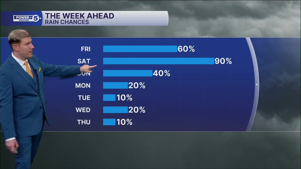
Plan on rain returning Friday evening, around sunset in the Cleveland metro, and earlier to the south, with heavier rain and thunder Friday night and into Saturday morning. Another, less intense round is likely later Sunday, and not as widespread. Flooding is a growing concern with training downpours, rounds of heavy rain that sit in the same areas for several hours. Some projections show nearly three inches of rain south of Akron by Sunday morning. While areawide it is overdone, and most locations will see between 1 and 1.5" of rain, isolated spots could exceed 2 inches. With an already saturated ground from Tuesday's downpours, flooding in poor drainage and prone areas is possible, especially south of US-30, with the NWS issuing a tier 2 of 4 risk for flash flooding through Friday night.
Temps will be slowly recovering each day. A bit more. It will be mostly dry on Memorial Day with highs near average. Not the worst forecast, luckily.
DAILY FORECAST:
Thursday: Still cool, breezy but brighter. | High: 60º
Friday: A bit milder with t-storms returning by sunset. | High: 70º
Saturday: Soaked. Rain could be heavy at times, especially in the morning and then in the evening. | High: 67º
Sunday: Few T-showers possible late. | High: 75º
Memorial Day Monday: Mostly cloudy. An isolated t-shower is possible. | High: 73º
Want the latest Power of 5 weather team updates wherever you go? Download the News 5 App free now: Apple|Android
Click here to view our interactive radar.
Follow the News 5 Weather Team:
Trent Magill: Facebook & Twitter
Katie McGraw: Facebook & Twitter
Phil Sakal: Facebook & Twitter
Allan Nosoff: Facebook & Twitter
