


CLEVELAND — It was another chilly day following a chilly weekend. The chill will continue tonight with 40s galore overnight and early on Tuesday. Grab an extra layer out the door in the morning, but you will be ditching that extra layer in the afternoon! Temperatures finally rebound back to where they belong in the upper 70s to near 80º. This is more typical for this time of year.
The warm-up is not just one day and done, either. Plan for seasonable temperatures near 80 degrees all week!
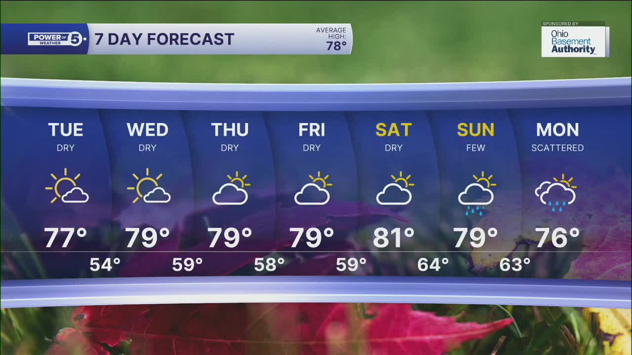
We are also not tracking rain for days. However, we are actually in need of rain across NEO. Drought has returned for portions of the area, and this drought will likely worsen over the next week with limited rain chances. The next *chance* is not until Sunday and Monday of next week. That is almost a week out! We will keep you posted on the likelihood of those showers occurring throughout the rest of the week.
In the meantime, enjoy the dry time and soak up some outdoor fun.
DAILY FORECAST:
Monday Night: Clear and cool. | Low: 50º
Tuesday: Sunny and warmer. | High: 78º
Wednesday: Mostly sunny and even warmer. | High: 79º
Thursday: Partly sunny and seasonable. | High: 78º
Friday: Partly sunny. Right on Par. | High: 77º
Saturday: Partly sunny and a touch warmer.| High: 81º
Sunday: More clouds. Rain showers are possible. | High: 77º
Want the latest Power of 5 weather team updates wherever you go? Download the News 5 App free now: Apple|Android
Click here to view our interactive radar.
Follow the News 5 Weather Team:
Trent Magill: Facebook & Twitter
Katie McGraw: Facebook & Twitter
Phil Sakal: Facebook & Twitter
Allan Nosoff: Facebook & Twitter
