CLEVELAND — Get ready for another wild weather day, Northeast Ohio. From a chilly start to a record-warm afternoon, to severe storms and flooding later in the evening, be prepared and have the News 5 app notifications turned on for severe alerts.
Highs are expected to reach the low 80s in the Cleveland metro, which will shatter today's current record, which is 77 degrees set back in 1882, more than a century ago! This sudden surge of warmth and humidity will help trigger more severe storms this evening. This comes just hours after rounds of heavy rain that resulted in flash flooding for several areas south of I-76 Friday evening.
Everyone could see some strong to severe storms after 5 p.m. through shortly after sunset. Storms could start popping as soon as 2 or 3 p.m., but those will be passing downpours, similar to the initial pop-ups Friday afternoon. The line of stronger storms will move from west to east after 5 p.m. with gusts of 60 to 70+ mph possible in any storms that turn severe.
The cold front will live up to its name. It will go from the 80s to the 40s, from Saturday to Easter Sunday, with a few isolated showers. The chill lingers for a couple of days before the next warm-up!
DAILY FORECAST:
Today: Very warm and humid. Evening storms. Could be damaging.| High: 81°
Easter: Colder again. Isolated mist and drizzle.| High: 40°
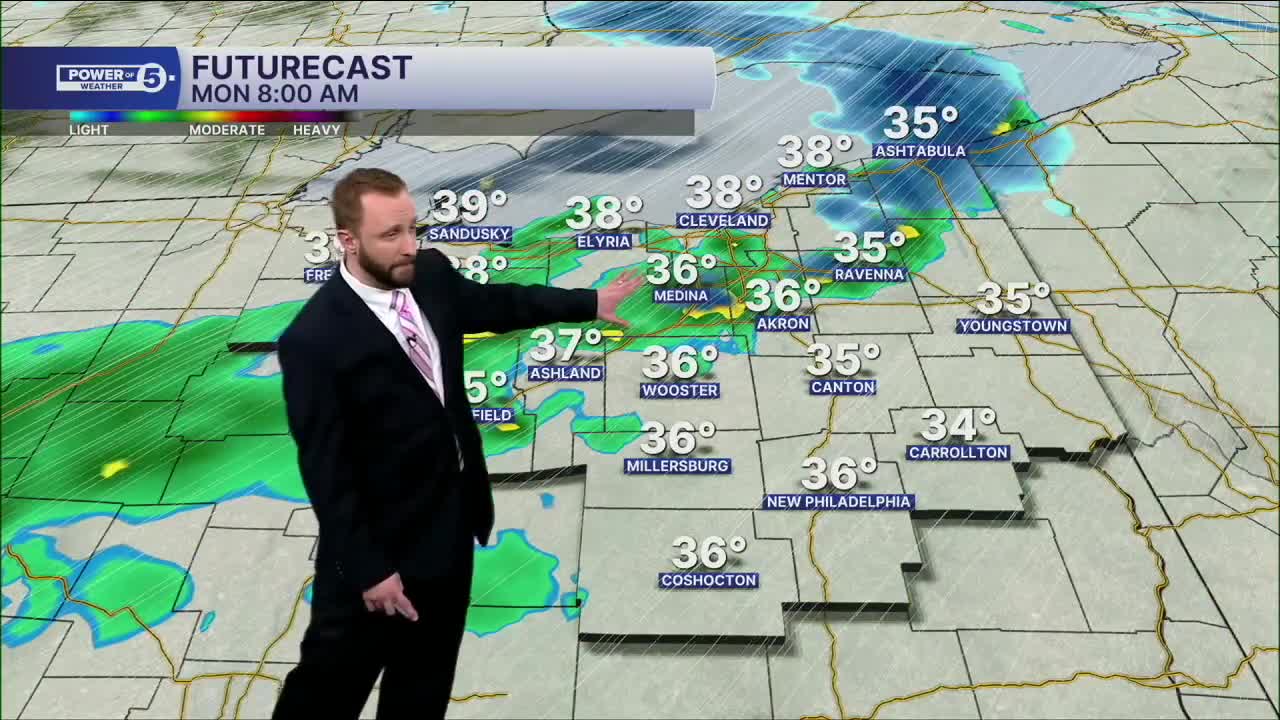
Monday: Morning mix of snow and rain, chilly.| High: 42°
Tuesday: Mostly cloudy and cold. Stray snow shower.| High: 39°
Wednesday: Mostly sunny and warmer.| High: 55°
Want the latest Power of 5 weather team updates wherever you go? Download the News 5 App free now: Apple|Android
Click here to view our interactive radar.
Follow the News 5 Weather Team:
Trent Magill: Facebook & Twitter
Katie McGraw: Facebook & Twitter
Phil Sakal: Facebook & Twitter
Allan Nosoff: Facebook & Twitter