



CLEVELAND —
Relief From the Humidity Is Finally on the Way
Finally! It is more comfortable across NEO. Skies will feature a few clouds, and areas of patchy fog will be possible. Temperatures will drop back into the lower 60s and even some mid to upper 50s will be possible to begin your Tuesday morning! Open those windows!
Power of 5 Regions Spotlight: West Region
The West Region has a chance of seeing mid 50s for overnight temperatures, as lower humidity levels move in from the northwest. Some patchy fog will be possible as well. Temperatures will begin to top off around 80 by Tuesday afternoon, under partly cloudy skies! A great day to be outside in our western communities!
Looking Ahead
Tuesday is looking much more comfortable. We'll start the day cooler with noticeably lower humidity, followed by a warm afternoon. Temps still climb into the warm category, but it won't have that sticky feel we've been dealing with recently.
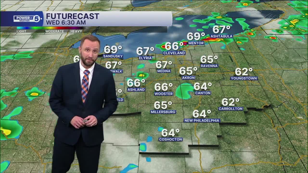
Storm chances return Wednesday as the next system approaches. Some of those storms could become strong, but the severe threat will depend heavily on timing. We'll be watching closely over the next couple of days. The good news is that even more comfortable air is expected to arrive behind those storms.
5-Day Forecast
Tuesday: Dry! Finally! | High: 80º
Wednesday: Few showers and isolated storms. | High: 79º
Thursday: Slim shot of t'shower. Cooler. | High: 77º
Friday: Mostly sunny & comfortable. | High: 79º
Learn the lingo: The Power of 5 Weather Team wants to get you your forecast closer to home. We have broken NEO into 5 separate and distinct regions. Find your region to get your hyper-local forecast!
- Cleveland Metro Region: Cuyahoga County. This region includes cities such as Cleveland, Parma, Westlake, Berea, Strongsville, Independence, Solon, Beachwood and Euclid.
- Snowbelt Region: Lake, Geauga and Ashtabula Counties. This includes cities such as Mentor, Geneva, Ashtabula, Bainbridge, Chardon, Burton and Orwell.
- Akron-Canton Region: Summit, Stark and Portage Counties. This region includes cities such as Akron, Canton, Hudson, Ravenna, Mantua, Alliance, and Canal Fulton.
- West Region: Lorain, Medina, Erie, Huron, Richland and Ashland Counties. This region includes cities such as Lorain, Wellington, Medina, Lodi, Ashland, Mansfield, Willard, and Sandusky.
- South Region: Wayne, Holmes, Tuscarawas, Carroll Counties. This region includes Wooster, Millersburg, New Philadelphia, Strasburg, Mineral City, Carrollton, and Newcomerstown
Want the latest Power of 5 weather team updates wherever you go? Download the News 5 App free now: Apple|Android
Click here to view our interactive radar.
Follow the News 5 Weather Team:
Trent Magill: Facebook & Twitter
Katie McGraw: Facebook & Twitter
Phil Sakal: Facebook & Twitter
Allan Nosoff: Facebook & Twitter
