


CLEVELAND — Happy October! It is officially layer season! You wake up to crisp and sometimes chilly temperatures, but then you're sweating by the afternoon!
And you will definitely want to layer up tonight and tomorrow morning. Temperatures are already dropping quickly, and lows will be in the 40s for much of NEO tonight and early on Thursday. Some spots will be flirting with the 30s!
It was a bright, breezy, and cooler day today, but winds will start to relax overnight. You can also kiss the seasonal temperatures goodbye for the next several days!
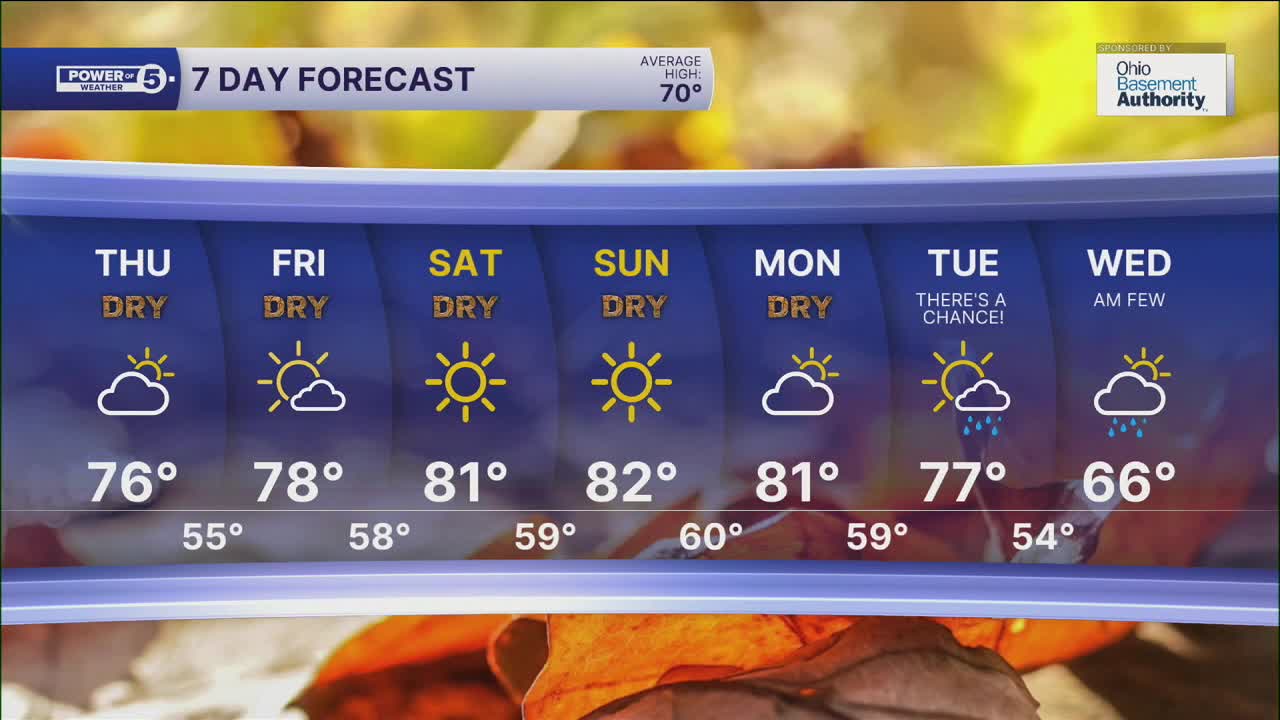
We climb back to the mid and upper 70s on Thursday, upper 70s to low 80s on Friday, and low to mid 80s look likely by this weekend! HOTober!
Rain chances appear to be on hold for several days as well. So you'll need to keep the plants watered once again.
September ended up below average for all of NEO. In Cleveland, it was the sixth driest September ever, with only 0.75 inches of rain at Cleveland Hopkins Airport. The current streak of dry days is 6 days, and that will likely grow to 10 or 11 days with the next chance for rain holding off until Tuesday or maybe even Wednesday...of NEXT week. That potential for rain also looks to usher
DAILY FORECAST:
Wednesday Night: CHILLY! Clear skies. | Low: 48º
Thursday: Partly sunny & warmer. | High: 78º
Friday: More sunshine and warm. | High: 80º
Saturday: Bright & hot (for October) | High: 82º
Sunday: Super sunny & hot. | High: 82º
Sunday: Still dry & hot. | High: 81º
Monday: There's a chance of rain! | High: 77º
Want the latest Power of 5 weather team updates wherever you go? Download the News 5 App free now: Apple|Android
Click here to view our interactive radar.
Follow the News 5 Weather Team:
Trent Magill: Facebook & Twitter
Katie McGraw: Facebook & Twitter
Phil Sakal: Facebook & Twitter
Allan Nosoff: Facebook & Twitter
