


CLEVELAND — Heading into the new week, a summer-like and stormy pattern will build and stay. It will be a tropical feel with well-above-average temperatures, high humidity, and daily storm chances. Highs will be well into the 80s all week long, with humidity increasing every day through Thursday. Highs in the 90s will be possible, especially on Monday and Thursday.
Because of the heat and humidity, the biggest threat with any storms that pass your area is flooding, as there is a lot of moisture, and these storms will dump a quick inch or two in a short time. We'll keep an eye the threat for severe storms as well.
A cold front will move through late Thursday into early Friday, and that will cool things down to wrap up the work week into next weekend.
DAILY FORECAST:
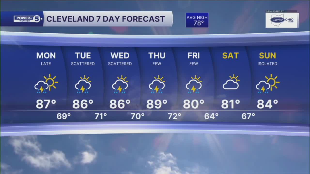
Monday: Partly sunny. More humid. Storm chances late.| High: 87º
Tuesday: Scattered storms. Humid.| High: 86º
Wednesday: Scattered Storms. Humid.| High: 86º
Thursday: Few storms. Hot & Humid.| High: 89º
Friday: Few storms. Cooler.| High: 80º
Saturday: Partly sunny. Drier.| High: 81º
Sunday: Isolated storm possible. Touch warmer.| High: 84º
Want the latest Power of 5 weather team updates wherever you go? Download the News 5 App free now: Apple|Android
Click here to view our interactive radar.
Follow the News 5 Weather Team:
Trent Magill: Facebook & Twitter
Katie McGraw: Facebook & Twitter
Phil Sakal: Facebook & Twitter
Allan Nosoff: Facebook & Twitter
