


CLEVELAND — Monday will be even more active than Sunday, with more widespread showers and thunderstorms during the midday and afternoon especially. A marginal severe risk also exists for Monday. Isolated damaging winds will be possible, mainly during the afternoon into the early evening. Heavy rain and lightning will be a concern as well.
Tuesday will feature on-and-off showers with a few embedded t-storms. While we need rainfall in the midst of this drought, but we also do not want too much rain too fast. The threat for heavy rain will be possible during the first half of the week, especially, and this may lead to some flooding concerns.
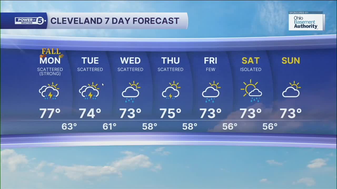
It will be cooler during the course of the week as the rainy pattern continues. Temperatures will be closer to average, with highs in the low and mid 70s for most of the week into next weekend.
Rain chances will begin to lessen, but not completely diminish until next Sunday. So keep the umbrellas handy NEO!
DAILY FORECAST:
Monday: Scattered rain showers. Few strong storms possible. | High: 77º
Tuesday: Rain showers and a few storms are likely. Mostly cloudy.| High: 74º
Wednesday: Scattered showers. Mostly cloudy.| High: 73º
Thursday: Scattered rain. Few storms. Mostly cloudy.| High: 75º
Friday: Few showers. Mostly cloudy.| High: 73º
Saturday: Isolated showers. Mostly cloudy.| High: 73º
Want the latest Power of 5 weather team updates wherever you go? Download the News 5 App free now: Apple|Android
Click here to view our interactive radar.
Follow the News 5 Weather Team:
Trent Magill: Facebook & Twitter
Katie McGraw: Facebook & Twitter
Phil Sakal: Facebook & Twitter
Allan Nosoff: Facebook & Twitter
