


CLEVELAND — As a cold front swings through early Mother's Day morning, showers will remain possible on Sunday morning, especially before 8 a.m., mainly in our southern communities. This front will also bring the return of chilly temperatures. Afternoon temps look to stay in the 50s for Mother's Day, which is running 15 to 20 degrees below typical for this time of year.
Temperatures will remain cooler than average through Friday, with more rain late Tuesday into Wednesday.
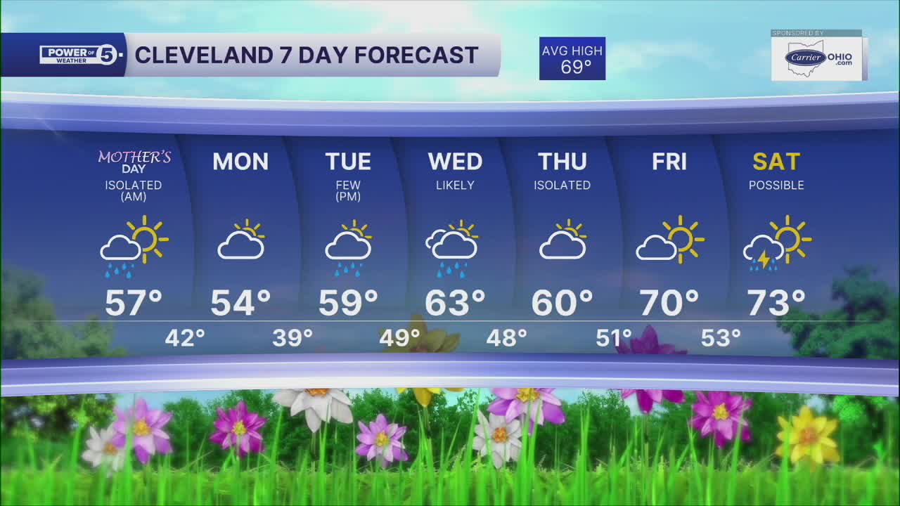
DAILY FORECAST:
Mother's Day: Drying out but chilly again. | High: 57º
Monday: Mostly dry but cloudy & cool. | High: 54º
Tuesday: Mostly cloudy, showers possible late. | High: 59º
Wednesday: Rain likely. Storm possible. | High: 63º
Thursday: Mostly cloudy, Isolated shower chance. | High: 60º
Friday: Partly cloudy. Seasonable. | High: 70º
Saturday: Rain possible. Touch Warmer. | High: 73º
Want the latest Power of 5 weather team updates wherever you go? Download the News 5 App free now: Apple|Android
Click here to view our interactive radar.
Follow the News 5 Weather Team:
Trent Magill: Facebook & Twitter
Katie McGraw: Facebook & Twitter
Phil Sakal: Facebook & Twitter
Allan Nosoff: Facebook & Twitter
