


CLEVELAND — Lake Erie itself is almost 50 degrees, which will keep frost very limited lakeside. We're still ahead of schedule if you're trying to plant your annuals. The rule in Northern Ohio is Memorial Day. We may get to bump that up a week or so this spring, but that means after May 15, which is still three weeks away. So, if you have any outdoor vulnerable plants, cover them or bring them inside the next few days.

A Frost and Freeze will once again be likely through Sunday morning. Many areas will see temperatures in the lower 30s by the wee hours of Sunday.

After a chilly start, it will get warmer by Sunday afternoon, with temperatures near 60 degrees, still nearly 10 degrees BELOW average though. It will remain warm through the early half of the workweek, but more rain is likely on multiple days during that span, particularly Tuesday into Wednesday. Rain could be heavy and contain storms, especially on Tuesday, but it is way too soon for specifics.
Another cold shot is likely to follow to end the new workweek, as highs fall back into the 40s and lower 50s by Thursday and Friday.
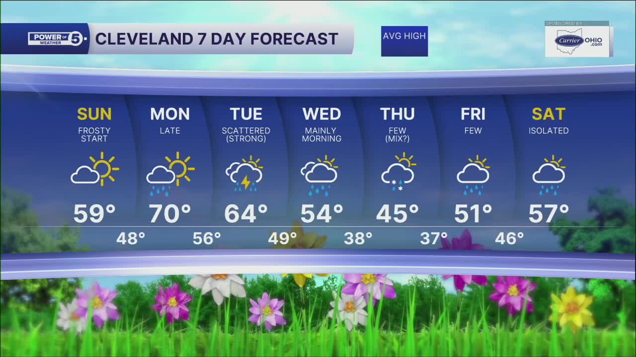
DAILY FORECAST:
Sunday: Frosty Start. More sunshine. Showers possible late. Warmer. | High: 59º
Monday: Mostly cloudy. Few Showers possible. | High: 68º
Tuesday: Mostly Cloudy. Scattered Rain. Few Storms. | High: 64º
Wednesday: Mainly morning rain. Cooler. | High: 54º
Thursday: Mostly Cloudy. Few Showers (Mix?). Colder. | High: 45º
Friday: Mostly Cloudy. Few Showers Possible. Not as Cold. | High: 51º
Saturday: Mostly Cloudy. Isolated Showers Possible. Warmer. | High: 57º
Want the latest Power of 5 weather team updates wherever you go? Download the News 5 App free now: Apple|Android
Click here to view our interactive radar.
Follow the News 5 Weather Team:
Trent Magill: Facebook & Twitter
Katie McGraw: Facebook & Twitter
Phil Sakal: Facebook & Twitter
Allan Nosoff: Facebook & Twitter
