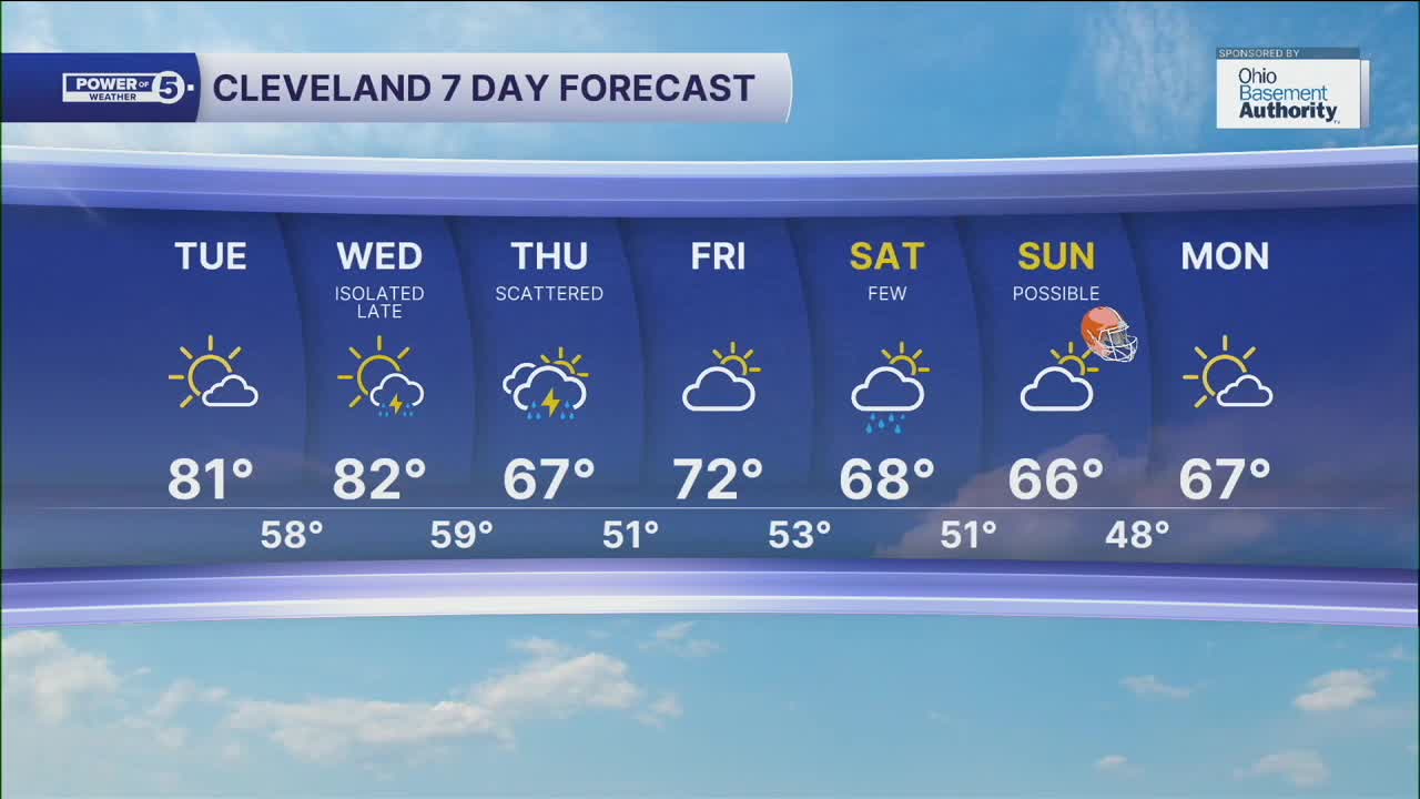


CLEVELAND — Temperatures will be around par for the first time in a week plus for many across NEO, as highs will top off around 80 on Tuesday and Wednesday. Skies will see more clouds, but sunshine will be had through Wednesday.
Rain chances will begin to arrive late Wednesday and will become more numerous on Thursday, as a cold front moves through the region. A few storms will be possible on Thursday as well. Temperatures will be much cooler with the clouds and rain. Highs will only warm into the mid to upper 60s on Thursday.
Rain chances will return for this weekend, along with more below-average conditions.
DAILY FORECAST:
Tuesday: Touch warmer. More sunshine. | High: 82º
Wednesday: Warm. Storms late. | High: 82º
Thursday: Showers and Storms. Much cooler. | High: 69º
Friday: Mostly dry. More clouds. | High: 71º
Saturday: Rain chances return. Cooler. | High: 66º
Sunday: Rain possible. Cool. | High: 66º
Want the latest Power of 5 weather team updates wherever you go? Download the News 5 App free now: Apple|Android
Click here to view our interactive radar.
Follow the News 5 Weather Team:
Trent Magill: Facebook & Twitter
Katie McGraw: Facebook & Twitter
Phil Sakal: Facebook & Twitter
Allan Nosoff: Facebook & Twitter
