


CLEVELAND — There is still a slight chance of a passing shower or downpour tonight, but most of NEO will stay dry. Clouds were already on the decline Thursday afternoon, and with clear skies, recent rain, and light winds, fog is expected overnight.
This is especially true east of I-71, but please be aware of the potential before you head out the door in the morning. It could make the morning commute slower. Fog should lift by about mid-morning at the latest. With fewer clouds, it will also be cooler tonight/Friday morning with lows in the 50s for much of NEO.
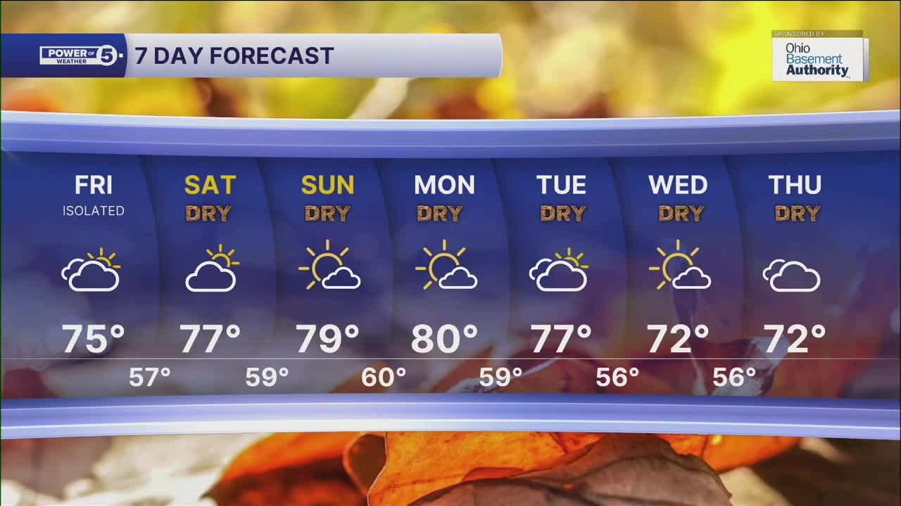
While an isolated shower cannot be ruled out on Friday, the forecast is trending drier and drier. All thanks to another large high-pressure system building in from the west. This means that while there is a low chance of seeing a shower or two tomorrow, there will be several communities that have seen their last drop for the next several days.
That's right! We are flipping the pattern back to dry and warm weather for the weekend and for the majority of the week to follow. Tomorrow will get back into the mid-70s, with upper 70s likely this weekend. We could reach the low to mid 80s by Sunday and early next week - fall who?!
DAILY FORECAST:
Tonight: Watch for areas of dense fog. Cooler, stray shower.| Low: 58º
Friday: Morning fog followed by afternoon sun.| High: 75º
Saturday: Dry, sunny, and warm.| High: 77º
Sunday: Even warmer! | High: 79º
Monday: August-like start to workweek. | High: 80º
Want the latest Power of 5 weather team updates wherever you go? Download the News 5 App free now: Apple|Android
Click here to view our interactive radar.
Follow the News 5 Weather Team:
Trent Magill: Facebook & Twitter
Katie McGraw: Facebook & Twitter
Phil Sakal: Facebook & Twitter
Allan Nosoff: Facebook & Twitter
