



CLEVELAND — We're trying to dry out, but stubborn clouds and incredibly high humidity are making it tough. I still can't rule out an isolated t-storm, even though the rest of our Friday is mainly dry. Just like we've been saying all week, that boundary is close enough. Meaning the trigger for more storms is too close to ignore.
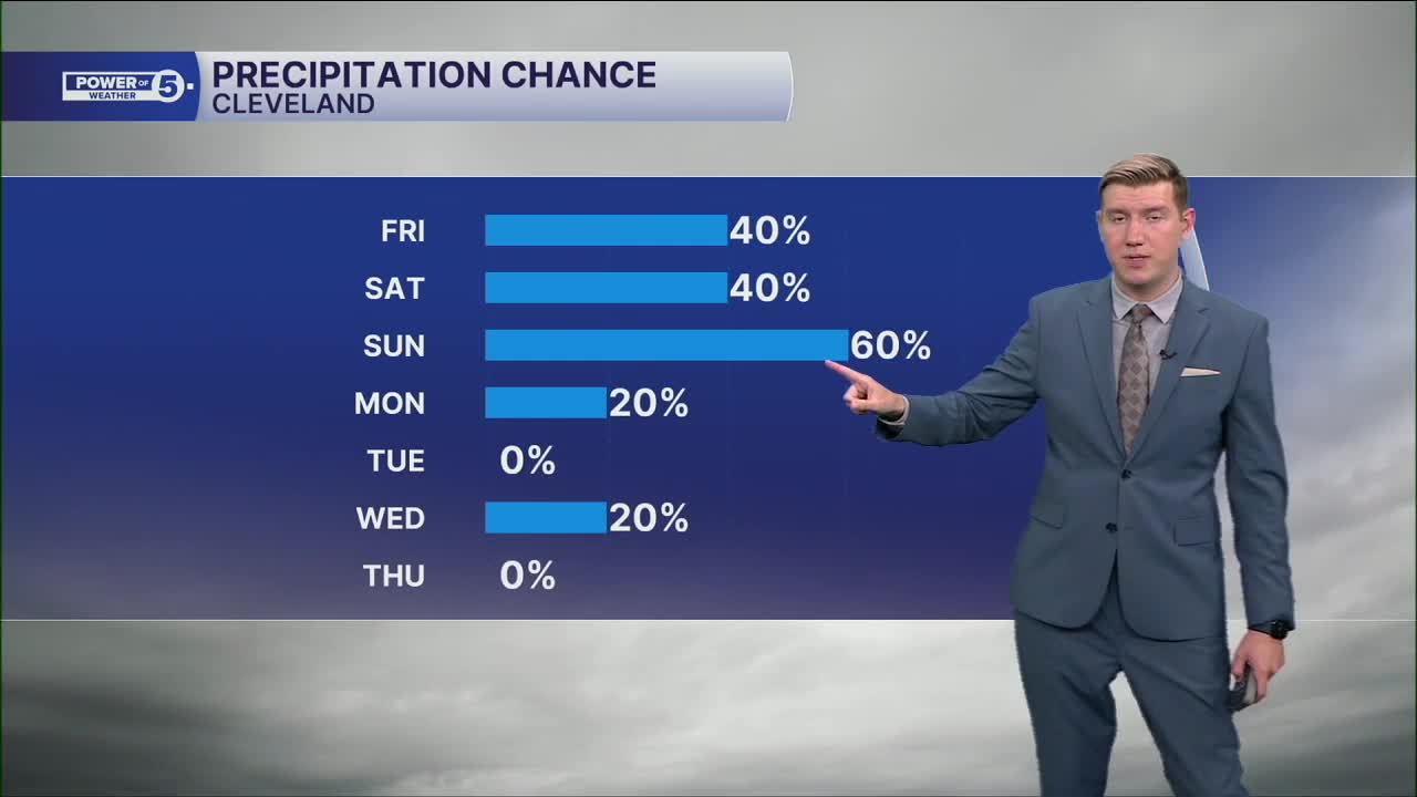
It's closer tomorrow. Saturday is looking more and more active. We'll likely be tracking a few t-showers early in the day; the main batch energy doesn't arrive until the evening, though. That's when we'll get in our shot at stronger storms. Have a way to get updates.
Sunday is still a bit too far away to cancel any plans, just know we're going to be tracking rain. Keep it in the back of your mind for any weekend plans. Sunday is more active than Saturday.
Power of 5 Regions Spotlight: South region
The first region to see rain this weekend will be south of US-30, especially for southern Holmes into Tuscarawas Counties. An isolated downpour also can't be ruled out as the morning showers exit by midday. More on the way Saturday night, too.
Looking Ahead
The break in the rain won't last long. Friday night and much of Saturday look mainly dry, giving us a nice window for outdoor plans.
Storm chances begin to increase late Saturday as the next system approaches. Sunday's weather looks much more active, with numerous showers and thunderstorms possible. Some of those storms could become strong to severe, with damaging wind being the primary concern. We'll continue to fine-tune the timing and threat level as we get closer.
Bottom Line
- Rain, a few storms, and downpours Friday morning
- Wettest weather favors the West and South Regions
- Drying out by midday with limited rain in the afternoon
- Mainly dry Friday night and early Saturday
- Storms return late Saturday
- More widespread storms Sunday, some could be strong to damaging
5-Day Forecast
Friday: Isolated t-showers, especially south.| High: 82º
Saturday: Isolated t-showers late. Mostly cloudy. | High: 84º
Sunday: Strong storms possible. | High: 86º
Monday: A Few t-showers. | High: 77º
Tuesday: Dry! Finally! | High: 78º
Learn the lingo: The Power of 5 Weather Team wants to get you your forecast closer to home. We have broken NEO into 5 separate and distinct regions. Find your region to get your hyper-local forecast!
- Cleveland Metro Region: Cuyahoga County. This region includes cities such as Cleveland, Parma, Westlake, Berea, Strongsville, Independence, Solon, Beachwood and Euclid.
- Snowbelt Region: Lake, Geauga and Ashtabula Counties. This includes cities such as Mentor, Geneva, Ashtabula, Bainbridge, Chardon, Burton and Orwell.
- Akron-Canton Region: Summit, Stark and Portage Counties. This region includes cities such as Akron, Canton, Hudson, Ravenna, Mantua, Alliance, and Canal Fulton.
- West Region: Lorain, Medina, Erie, Huron, Richland and Ashland Counties. This region includes cities such as Lorain, Wellington, Medina, Lodi, Ashland, Mansfield, Willard, and Sandusky.
- South Region: Wayne, Holmes, Tuscarawas, Carroll Counties. This region includes Wooster, Millersburg, New Philadelphia, Strasburg, Mineral City, Carrollton, and Newcomerstown
Want the latest Power of 5 weather team updates wherever you go? Download the News 5 App free now: Apple|Android
Click here to view our interactive radar.
Follow the News 5 Weather Team:
Trent Magill: Facebook & Twitter
Katie McGraw: Facebook & Twitter
Phil Sakal: Facebook & Twitter
Allan Nosoff: Facebook & Twitter
