

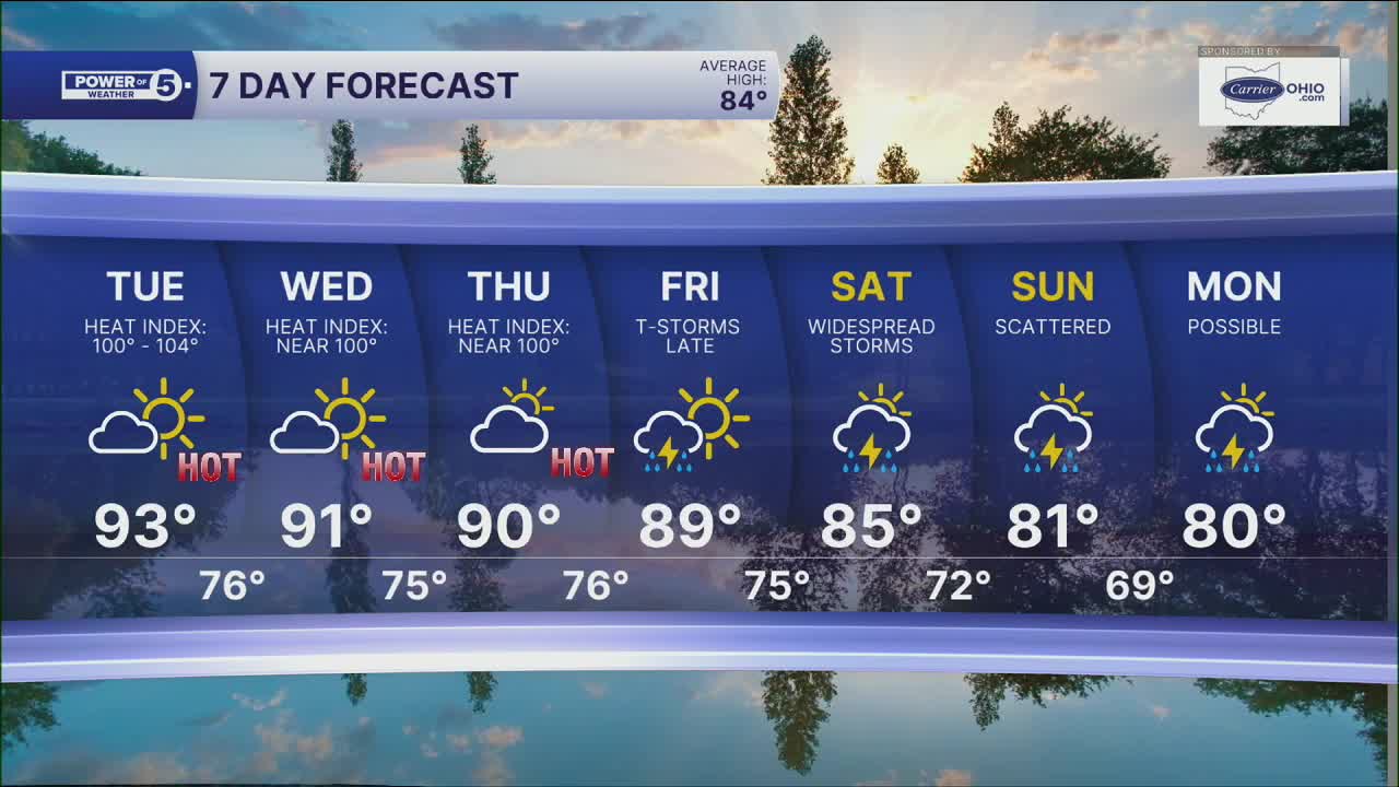


CLEVELAND — More sunshine and even more warmth are expected for the next few days. It was already a couple of degrees warmer on Monday compared to Sunday. And temperatures will climb a couple more degrees on Tuesday.
90+ expected on Tuesday and Wednesday, and with dew points climbing, it will feel even hotter! Heat index values up to 100 are likely for many, with a few communities climbing over 100 degrees. A heat advisory has been issued for a handful of counties on Tuesday across NW Ohio.
Rain chances will be slim pickings for most of the week as the heat dome sets up shop, with the next shot of any rain not happening until Friday. Rain chances will linger into the weekend, with the best shot on Saturday. Strong to Severe storms will be possible this weekend, so we'll keep an eye on it for you, so stay connected! On and off showers and storms look to continue on Sunday and even into next week.
As storm chances increase, temperatures will decrease. Highs will dip back into the 80s by the weekend.
DAILY FORECAST:
Monday Night: Mostly clear, mild & muggy.| Low: 71º
Tuesday: Hazy, hot, and humid. Feels like 100.| High: 93º
Wednesday: Hazy, hot, and humid. Feels like 100.| High: 91º
Thursday: Partly cloudy. Hazy, hot, and humid.| High: 90º
Friday: Few storms. Hot and humid.| High: 89º
Saturday: Few storms possible. Muggy.| High: 87º
Want the latest Power of 5 weather team updates wherever you go? Download the News 5 App free now: Apple|Android
Click here to view our interactive radar.
Follow the News 5 Weather Team:
Trent Magill: Facebook & Twitter
Katie McGraw: Facebook & Twitter
Phil Sakal: Facebook & Twitter
Allan Nosoff: Facebook & Twitter
