


CLEVELAND — It will be even warmer on Thursday ahead of the aforementioned front. It will be hard to enjoy, winds will gust in excess of 40 to 50 mph during the afternoon and evening. Thunderstorms will move in later into the evening with the actual front moving into the region.
Highs are expected to reach the middle 50s, and even some south of Canton could reach 60 degrees. Showers are possible west of Cleveland through the afternoon, and a squall line of strong storms and 60 mph gusts is expected to cross the metro between 7 and 9 PM Thursday. It will be like a springtime storm. The timing looks to be in our favor now, with the storm slowing down enough to spare the evening commute from the brunt of the storm.
As this will be a strong cold front, there is a high chance for a flash freeze into Thursday night as temperatures drop from the 50s to the lower 20s in less than 12 hours, one of the biggest drops on record. And lake effect snow showers will develop into Friday morning, dropping light accumulations during the day Friday in the primary and secondary snowbelts.
DAILY FORECAST:
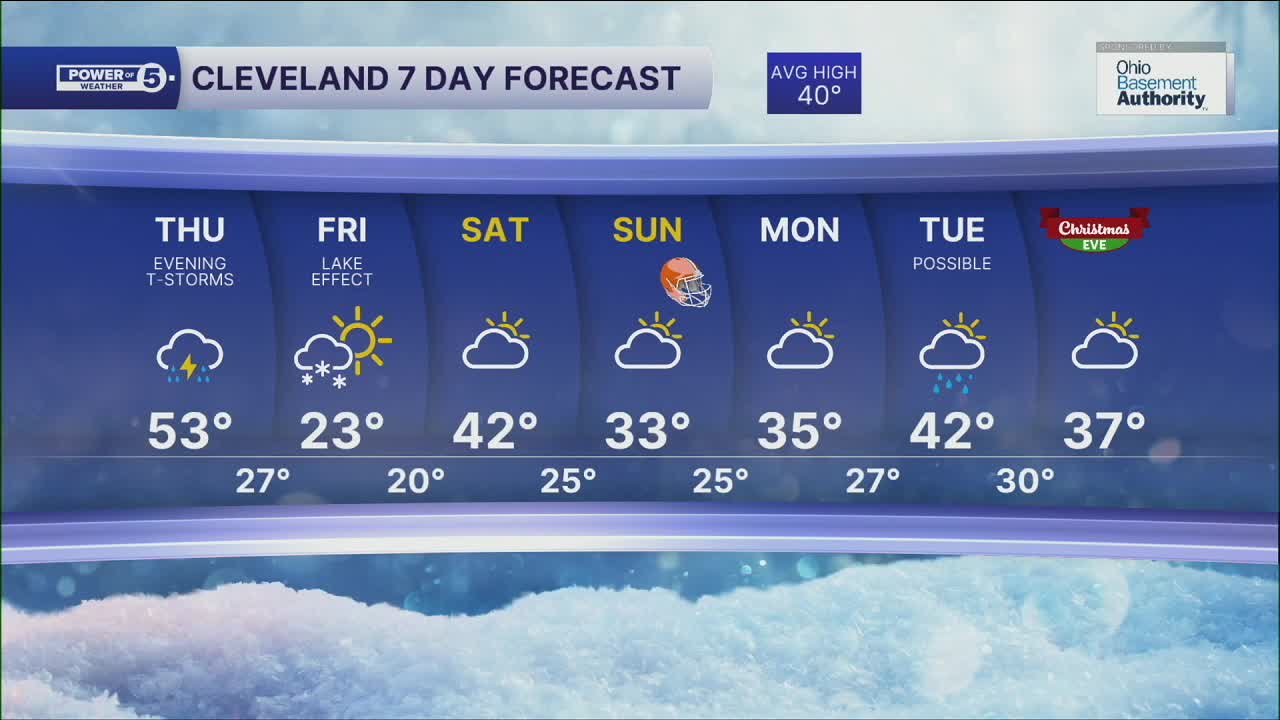
Thursday: Evening Rain/Thunder. Warmer & Windy. | High: 53º
Friday: Lake effect snow showers. Windy and Colder. | High: 23º
Saturday: Mostly Cloudy and Warmer. | High: 42º
Sunday: Mostly cloudy. Chilly. | High: 33º
Monday: Mostly cloudy. Chilly. | High: 35º
Tuesday: Rain showers possible. Touch warmer. | High: 42º
Christmas Eve: Mostly cloudy. Chilly. | High: 37º
Want the latest Power of 5 weather team updates wherever you go? Download the News 5 App free now: Apple|Android
Click here to view our interactive radar.
Follow the News 5 Weather Team:
Trent Magill: Facebook & Twitter
Katie McGraw: Facebook & Twitter
Phil Sakal: Facebook & Twitter
Allan Nosoff: Facebook & Twitter
