


CLEVELAND — Temperatures will remain cooler than average for most of the work week.
Frost is possible tonight into early Tuesday, with temperatures falling into the mid- to upper 30s as skies are mostly clear with light winds. A frost advisory has been issued for the majority of NEO from midnight until 8 am on Wednesday. A freeze warning has been issued for inland Ashtabula County, as well as Trumbull County.
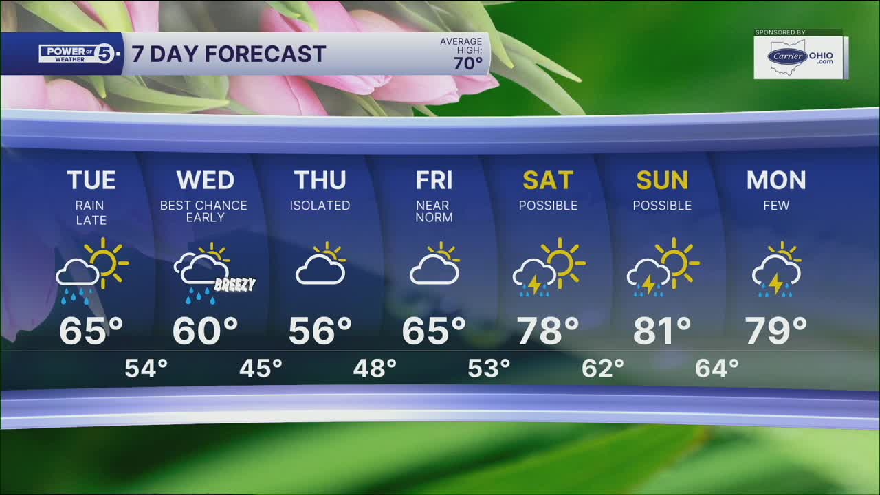
After a frosty morning, temperatures, winds, clouds, and rain chances will all be increasing on Tuesday. Highs will be in the mid to upper 60s with breezy winds out of the southwest. Clouds will be increasing by the afternoon. A few showers will be possible by the early evening along the lakeshore. Rain will become more likely after 10 pm for the entire viewing area until about noon on Wednesday. A few stray storms will be possible on Wednesday afternoon in our easternmost communities.
The rest of Wednesday, Thursday, and Friday will remain mostly dry and cool, and a cold front will pause the warmup until this weekend. 80s are likely to return this weekend as a heat dome builds from the west! Summer is coming!
DAILY FORECAST:
Monday Night: Clear, calm & frosty.| Low: 38º
Tuesday: AM frost. Clouds increasing. Showers possible late. | High: 65º
Wednesday: Rain likely. Storm possible. | High: 61º
Thursday: Mostly cloudy, Isolated shower chance. | High: 55º
Friday: Partly cloudy. Seasonable. | High: 64º
Saturday: Isolated rain chance. Warmer. | High: 76º
Want the latest Power of 5 weather team updates wherever you go? Download the News 5 App free now: Apple|Android
Click here to view our interactive radar.
Follow the News 5 Weather Team:
Trent Magill: Facebook & Twitter
Katie McGraw: Facebook & Twitter
Phil Sakal: Facebook & Twitter
Allan Nosoff: Facebook & Twitter
