


CLEVELAND — Goodbye clouds! Hello sun!
Clouds eroded quickly this evening as high pressure sinks south across the Great Lakes. Tonight will be much calmer with clear skies, but that will make it feel a bit cool overnight and early on Friday. Expect low 60s and some upper 50s inland by sunrise on Friday. But we'll have a great-looking sunrise.
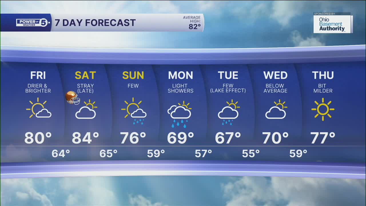
There will be a lot more sun, allowing for warmer temperatures to start the weekend. Highs will be in the upper 70s to low 80s on Friday afternoon, and we will remain dry throughout the day and into Friday evening.
Saturday will be even warmer with mid-80s returning, and a few more clouds. The forecast for the Browns Game looks great! Most of the day will be dry on Saturday, but a stray shower is possible by Saturday night. The shower chance creeps up a bit on Sunday with a few t-showers possible as a powerhouse cold front rolls through NEO. Temperatures will fall quickly into early next week with lake effect rain showers on Monday and Tuesday with highs in the SIXTIES!
DAILY FORECAST:
Thursday Night: Much clearer with lighter winds. Cool| Low: 62º
Friday: Mostly sunny and warmer. | High: 78º
Saturday: Touch warmer. Plenty of dry time. Evening t-showers.| High: 82º
Sunday: A few t-showers.| High: 76º
Monday: A taste of fall. Lake effect rain showers are possible.| High: 69º
Tuesday: Even cooler. Lake effect rain showers are still possible.| High: 67º
Want the latest Power of 5 weather team updates wherever you go? Download the News 5 App free now: Apple|Android
Click here to view our interactive radar.
Follow the News 5 Weather Team:
Trent Magill: Facebook & Twitter
Katie McGraw: Facebook & Twitter
Phil Sakal: Facebook & Twitter
Allan Nosoff: Facebook & Twitter
