


CLEVELAND — Happy Halloween! The rest of this spooky holiday will feature an overcast sky, chilly temperatures, and a couple of very light lake effect showers. After two gusty days, winds are subsiding overnight and into Saturday.
This weekend will also feature a couple more showers, but there will be plenty of dry time. In fact, you have a much better chance of staying completely dry with variable clouds and peeks of sun. The best locations to pick up any rain will be in our NE communities in the snowbelt. Highs will be slightly below average to start November, with temps in the low and mid 50s, and winds will be much calmer. Plan for southwesterly winds at 5-15 mph.
There is an even smaller chance for rain on Sunday with highs in the mid to upper 50s.
Reminder: The time change is this weekend. We "fall back" on Sunday at 2 am. The sunset will be around 5:20 pm on Sunday. Winter is coming! And so are not one, but two clippers next week. They typically bring snow during the winter, but these will just bring a few passing rain showers on Monday, with a better shot at rain on Wednesday.
DAILY FORECAST:
Halloween Night: Chilly. Isolated lake-effect showers.| Low: 41º
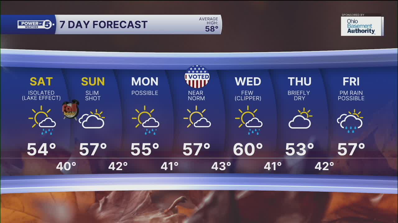
Saturday: Isolated lake effect rain. Chilly but less windy. | High: 54º
Sunday: Slim shot for rain for the lakeshore, still cool and partly cloudy. | High: 55º
Monday: Rain is possible late. Seasonable. | High: 57º
Tuesday: Mostly sunny and cool. | High: 55º
Want the latest Power of 5 weather team updates wherever you go? Download the News 5 App free now: Apple|Android
Click here to view our interactive radar.
Follow the News 5 Weather Team:
Trent Magill: Facebook & Twitter
Katie McGraw: Facebook & Twitter
Phil Sakal: Facebook & Twitter
Allan Nosoff: Facebook & Twitter
