


CLEVELAND — There will be another round of snow coming on Sunday. Snow shower chances will be more widespread, but remaining light. Accumulations will be minimal, as most areas will only see a trace up to an inch. A pocket of 2" will be possible, especially in the snowbelt region. We'll be in the lower 30s again, so plan on slushy accumulations. So plan on adding a few extra minutes to your travels across the region, especially during the afternoon hours.
The active pattern will continue into the new work week, with several systems moving through the region. We'll see a brief break on Monday, along with colder temperatures. Otherwise, anticipate more snow for the most part next week; but on Wednesday, as highs top off near 40, we could see a rain/snow mix for your mid-week.
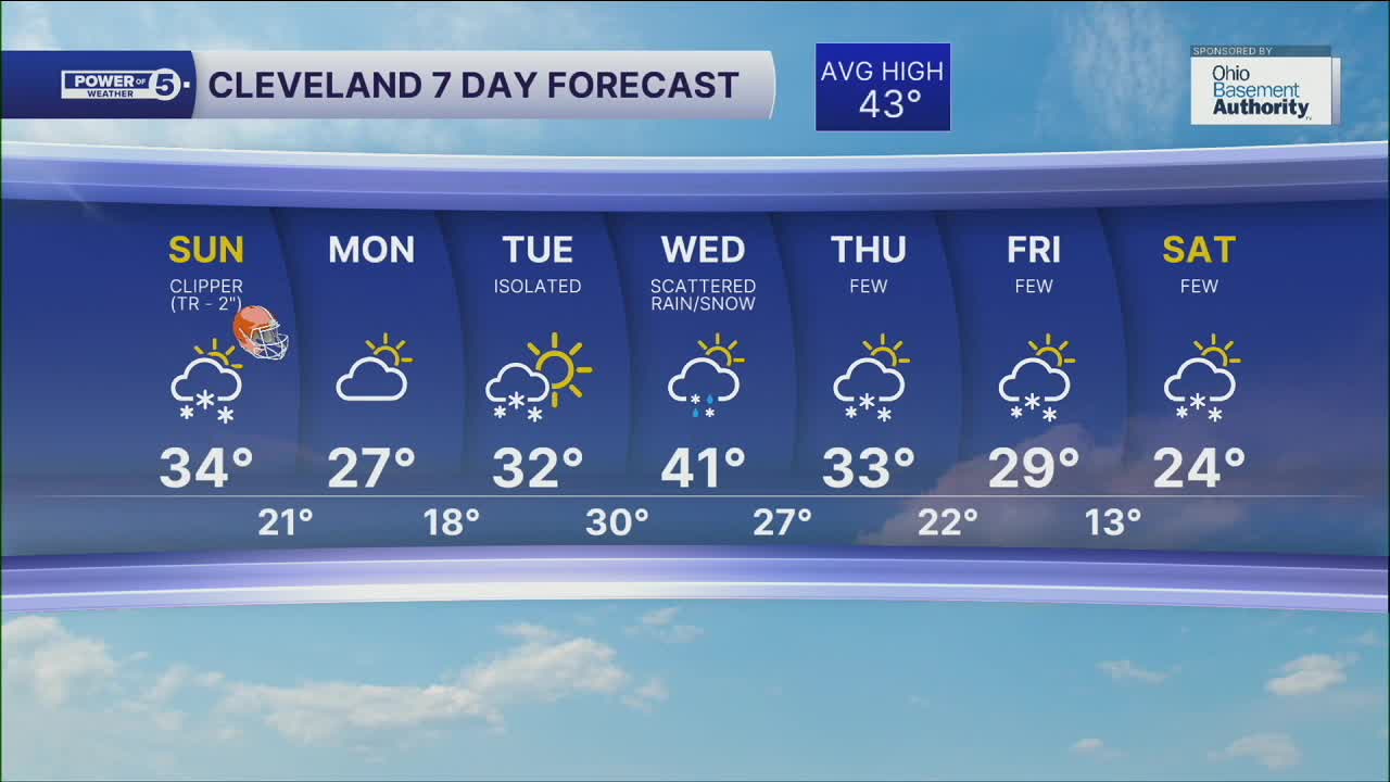
DAILY FORECAST:
Sunday: Snow showers for the Browns game. | High: 34º
Monday: Cold and drier. | High: 27º
Tuesday: Few snow showers. Still cold. | High: 32º
Wednesday: Scattered rain/snow mix. | High: 41º
Thursday: Colder. Few snow showers. | High: 33º
Friday: Colder again. Few snow showers. | High: 29º
Saturday: Colder. Few snow showers. | High: 24º
Want the latest Power of 5 weather team updates wherever you go? Download the News 5 App free now: Apple|Android
Click here to view our interactive radar.
Follow the News 5 Weather Team:
Trent Magill: Facebook & Twitter
Katie McGraw: Facebook & Twitter
Phil Sakal: Facebook & Twitter
Allan Nosoff: Facebook & Twitter
