



CLEVELAND — Hit-and-miss storms were the name of the game Friday afternoon and evening. Storms packed torrential rainfall, which resulted in localized flooding across Summit, Portage, Wayne, and Tuscarawas Counties. The good news is that the worst has passed!
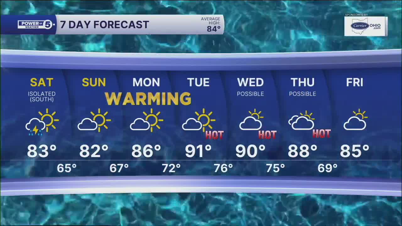
The weekend is shaping up much nicer. It will feel and look much better! Saturday brings drier weather, more sunshine, and highs in the lower 80s. A couple of isolated downpours and storms cannot be ruled out, but most will stay dry.
Sunday looks even better, with plenty of sun, comfortable temperatures in the low 80s, and great weather for outdoor plans! Humidity will be low too on Sunday, so it will feel great too!
Another warming trend is setting up for next week. 90s will be possible again, and with dew points climbing, it will feel even hotter!
CLIFF NOTES:
- Isolated storms on Saturday, especially in the southern half of our viewing area
- Drier with more sunshine Saturday, highs in the low 80s
- Sunny and pleasant Sunday, low 80s
- Excellent outdoor weather this weekend
- Another round of 90s next week
DAILY FORECAST:
Saturday: Isolated t-shower south, mostly dry and comfy. | High: 80º
Sunday: More sun, feeling great. | High: 81º
Monday: Heating up. | High: 86º
Tuesday: HOT! | High: 91º
Want the latest Power of 5 weather team updates wherever you go? Download the News 5 App free now: Apple|Android
Click here to view our interactive radar.
Follow the News 5 Weather Team:
Trent Magill: Facebook & Twitter
Katie McGraw: Facebook & Twitter
Phil Sakal: Facebook & Twitter
Allan Nosoff: Facebook & Twitter
