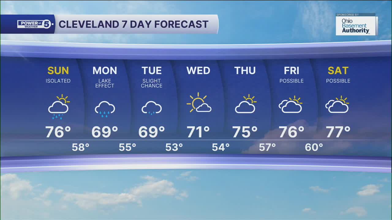


CLEVELAND — An isolated shower and or t'shower will be possible on Sunday, with highs only in the mid to upper 70s for most of the region. This will be the warmest day for most of the area until the end of the workweek and into next weekend.
The coldest air since the start of June will move into Northeast Ohio for the beginning of the final workweek of August. Highs may not break 70 in many areas on Monday and Tuesday. This cool air moving over a warm Lake Erie will bring the threat of Lake Effect Rain to some on Monday, especially, and may linger into Tuesday.
We will slowly warm to round out the week, along with mostly dry conditions. A shower chance will begin to return by late Friday into Saturday.
DAILY FORECAST:
Sunday: Isolated showers. Cooler.| High: 76º
Monday: A taste of fall. Lake effect rain showers.| High: 69º
Tuesday: Cooler again. Lake effect rain showers are still possible.| High: 69º
Wednesday: Brighter but still cool. | High: 71º
Want the latest Power of 5 weather team updates wherever you go? Download the News 5 App free now: Apple|Android
Click here to view our interactive radar.
Follow the News 5 Weather Team:
Trent Magill: Facebook & Twitter
Katie McGraw: Facebook & Twitter
Phil Sakal: Facebook & Twitter
Allan Nosoff: Facebook & Twitter
