


CLEVELAND — After storms fade Saturday evening, Sunday will be reminiscent of the last two weeks with slightly cooler temperatures and dry weather returning.
As we head into next week, the summer-like and stormy pattern will hang around! It will be hot with temperatures in the 80s and perhaps even into the low 90s with noticeable humidity. That will make it feel hotter and stickier! Plus, daily storm chances are also on the 7-Day forecast.
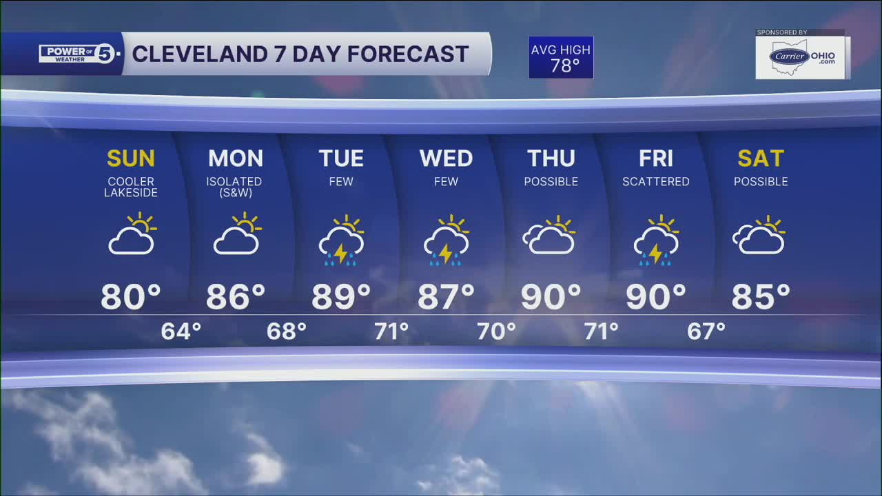
DAILY FORECAST:
Sunday: Drying out with increasing sunshine. Still humid.| High: 80º
Monday: Mostly sunny. Muggy. Isolated PM storm S&W.| High: 86º
Tuesday: Few storms. Warm and sticky.| High: 89º
Wednesday: Few Storms. Warm and sticky.| High: 87º
Thursday: Storm possible. Hot & Humid.| High: 90º
Friday: Scattered storms. Hot & Humid.| High: 90º
Thursday: Storm possible. Muggy.| High: 85º
Want the latest Power of 5 weather team updates wherever you go? Download the News 5 App free now: Apple|Android
Click here to view our interactive radar.
Follow the News 5 Weather Team:
Trent Magill: Facebook & Twitter
Katie McGraw: Facebook & Twitter
Phil Sakal: Facebook & Twitter
Allan Nosoff: Facebook & Twitter
