


Winter Weather Advisory in effect until 1pm Tuesday
Lake Effect Snow Warning in effect until 1pm Tuesday
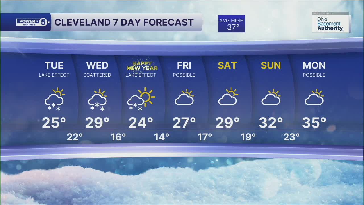
Winter is back across Northeast Ohio...
Anticipate breezy conditions, with gusts of 30 to 40 mph through Tuesday.
Lake Effect Snow will continue to be a concern in the snowbelt region. With the breezy conditions, visibility will be greatly reduced, with whiteout conditions at times. So take extra time to get anywhere in the snowbelt, especially.
Parts of the snowbelt will see 4" to 8"+ totals, where squalls persist through Tuesday, especially in Geauga County.
Temperatures will remain well below average, with many areas in the low to mid 20s to round out your Tuesday, but wind chills will be in the single digits and teens at times.
More snow will move in for New Year's Eve, as a clipper moves into Northeast Ohio, and behind it more lake effect sets up to round out 2025 and begin 2026.
Stay warm and stay safe!
DAILY FORECAST:
Tuesday: Gusty, cold with lake effect snow. | High: 25º
New Year's Eve: Cold with scattered snow. | High: 29º
New Year's Day: Cold to start 2026. Lake effect snow possible. | High: 24º
Friday: Snow possible. | High: 27º
Want the latest Power of 5 weather team updates wherever you go? Download the News 5 App free now: Apple|Android
Click here to view our interactive radar.
Follow the News 5 Weather Team:
Trent Magill: Facebook & Twitter
Katie McGraw: Facebook & Twitter
Phil Sakal: Facebook & Twitter
Allan Nosoff: Facebook & Twitter
