


CLEVELAND — We'll be rounding out your Saturday on a warm and muggy note, under mostly clear skies. Overnight lows will only fall back into the upper 60s to around 70 in many locations.
Another hot and humid day is in store across NEO for your Sunday, as we'll be nearing 90 for the first time this month in many locations. Skies will be mostly sunny once again, along with a slim shot of a pop-up storm during the afternoon, but most of the region will be dry once again.
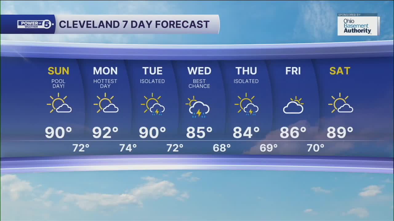
Rain chances will be slim shots for the start of the new work week, until a cold front begins to move in late Tuesday through early Thursday. We will see isolated storm chances on Tuesday and once again on Thursday, with few to scattered chances of storms on Wednesday. Even with a front moving through the region, not everyone will see rain, so you'll need to keep those gardens watered!
Temperatures are expected to remain above average for most of the next week, accompanied by more noticeable humidity. So stay cool everyone!
DAILY FORECAST:
Tonight: Warm and muggy. Mostly clear. | Low: 70º
Sunday: Hot Hot Hot. | High: 90º
Monday: Hottest day. Humid. | High: 92º
Tuesday: Hot and humid, storm chance late | High: 90º
Wednesday: More scattered storms possible. | High: 85º
Thursday: A bit cooler with a chance of showers/storms. | High: 84º
Friday: Drier and warming up again. | High: 86º
Saturday: Humid. Mostly sunny. | High: 89º
Want the latest Power of 5 weather team updates wherever you go? Download the News 5 App free now: Apple|Android
Click here to view our interactive radar.
Follow the News 5 Weather Team:
Trent Magill: Facebook & Twitter
Katie McGraw: Facebook & Twitter
Phil Sakal: Facebook & Twitter
Allan Nosoff: Facebook & Twitter
