


CLEVELAND — After a chilly start, the temperatures rebounded nicely on Thursday. Lows dropped into the 40s Thursday morning, but climbed to the upper 70s by the afternoon.
It will be chilly tonight as well...just not AS chilly. Lows in the 50s will be a lot more common, with only a few isolated 40s overnight.
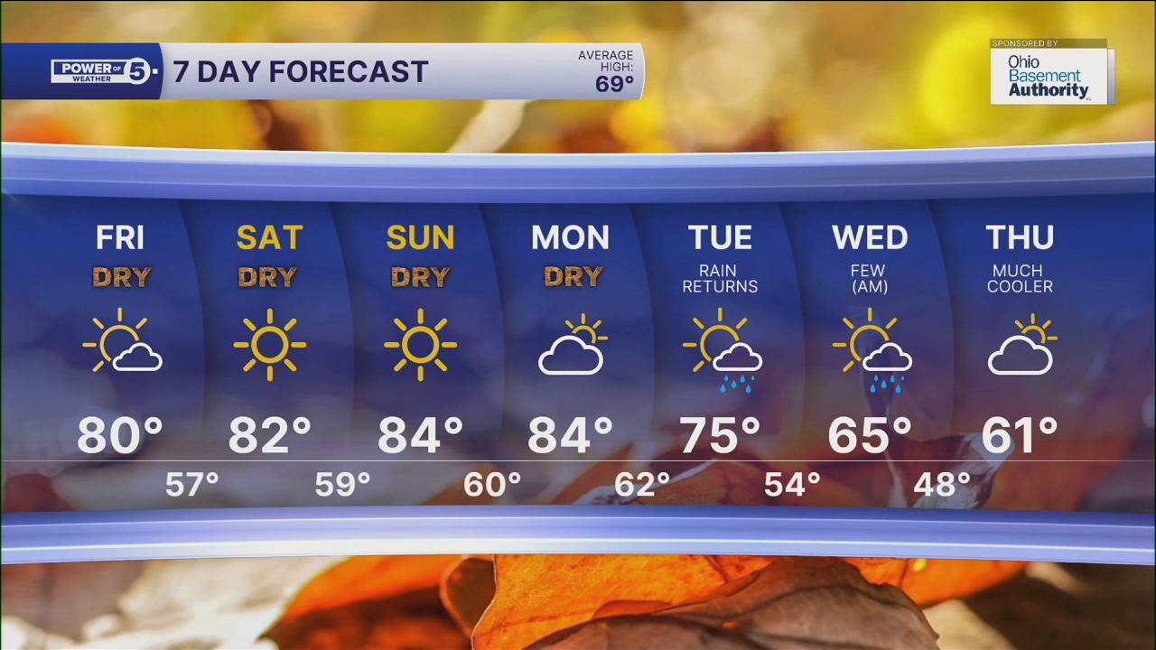
Friday rebounds closer to 80 degrees for everyone with plenty of sun. Despite the lower sun angle, make sure to stay protected with sunscreen, as you can burn within an hour under direct sunlight.
It continues to heat up this weekend, with highs progressing from the low 80s to even the mid-80s. Lows will be in the upper 50s to near-60 degrees in the morning, so plan to wear layers! Sweaters early, then t-shirts and shorts by the afternoon.
It will remain dry again for Friday and the entire weekend, but that will change early next week. A chance for rain returns after another 10-plus day stretch without rain across Northeast Ohio by Tuesday and Wednesday.
It also looks like temperatures will take a turn around that time. Highs could drop into the 60s by the middle of next week! Yo-yo temperatures are here!
DAILY FORECAST:
Friday: More sunshine and warm. | High: 80º
Saturday: Bright & hot (for October) | High: 81º
Sunday: Super sunny & hot. | High: 82º
Monday: More clouds but staying warm. | High: 83º
Tuesday: Partly cloudy with a chance of showers & storms. | High: 77º
Want the latest Power of 5 weather team updates wherever you go? Download the News 5 App free now: Apple|Android
Click here to view our interactive radar.
Follow the News 5 Weather Team:
Trent Magill: Facebook & Twitter
Katie McGraw: Facebook & Twitter
Phil Sakal: Facebook & Twitter
Allan Nosoff: Facebook & Twitter
