



CLEVELAND — Wow, what a change a day can make! After not even hitting 50 degrees on Saturday, it got up to 79 degrees on Sunday, just as our Power of 5 forecast predicted.
There was an isolated pop-up shower near Sandusky earlier in the afternoon, but most areas dodged any rain today. That changes overnight.
Rain moves in after midnight, from west to east, starting in Cleveland around 1 a.m., with a few embedded downpours too. It will be a soggy and humid start to Monday for the commute, but then some sun and more warmth returns by the afternoon.
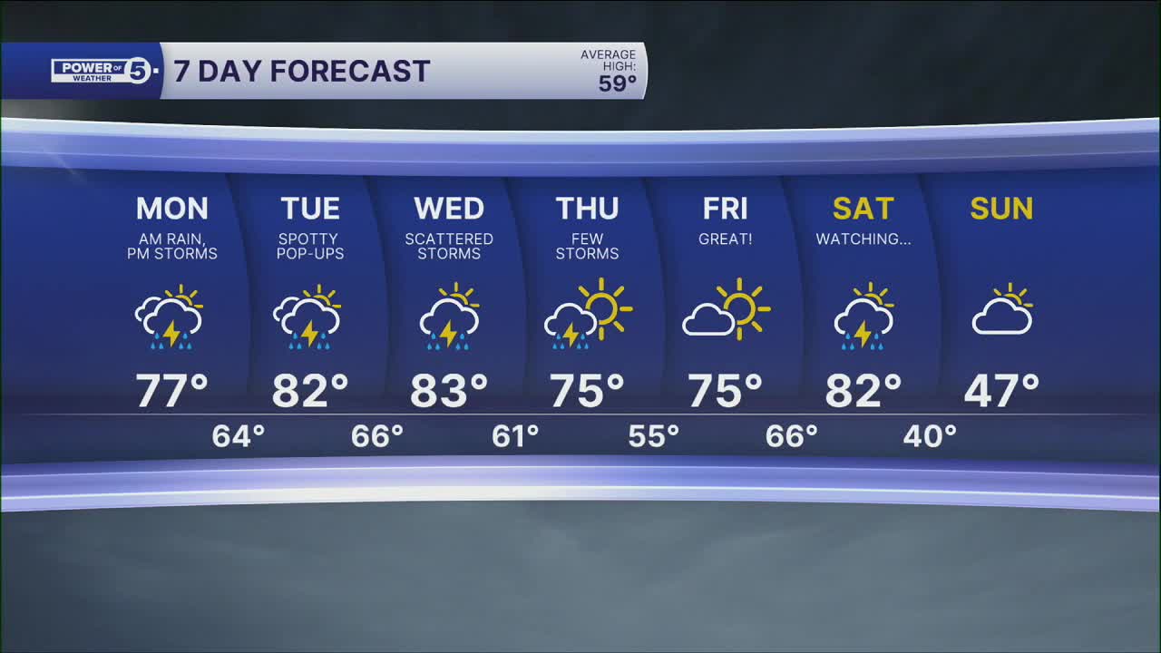
This warmth is expected all workweek long, which means it is our first sustained warmth of 2026. But — with the warmth comes the return of daily storm chances. Although each day has a chance for sporadic storms, it does not look like a washout every single day. The best chance for heavier rain is Monday morning and Tuesday night.
We will be watching for any stronger storms next week as well.
DAILY FORECAST:
Tonight: Warm and humid. Rain likely.| Low: 65°
Monday: Morning rain. Afternoon storms.| High: 77°
Tuesday: PM storms possible. Humid.| High: 83°
Wednesday: Chance of storms. Humid.| High: 82°
Thursday: Storms taper. Not as humid.| High: 79°
Want the latest Power of 5 weather team updates wherever you go? Download the News 5 App free now: Apple|Android
Click here to view our interactive radar.
Follow the News 5 Weather Team:
Trent Magill: Facebook & Twitter
Katie McGraw: Facebook & Twitter
Phil Sakal: Facebook & Twitter
Allan Nosoff: Facebook & Twitter
