


CLEVELAND — it will remain dry throughout the day and into Friday evening. Saturday will be even warmer, with mid-80s temperatures returning, but accompanied by a few more clouds.
The forecast for the Browns Game looks great! Most of the day will be dry, but clouds will be increasing throughout the day, and a stray shower is possible by Saturday evening, especially in our northern and western communities.
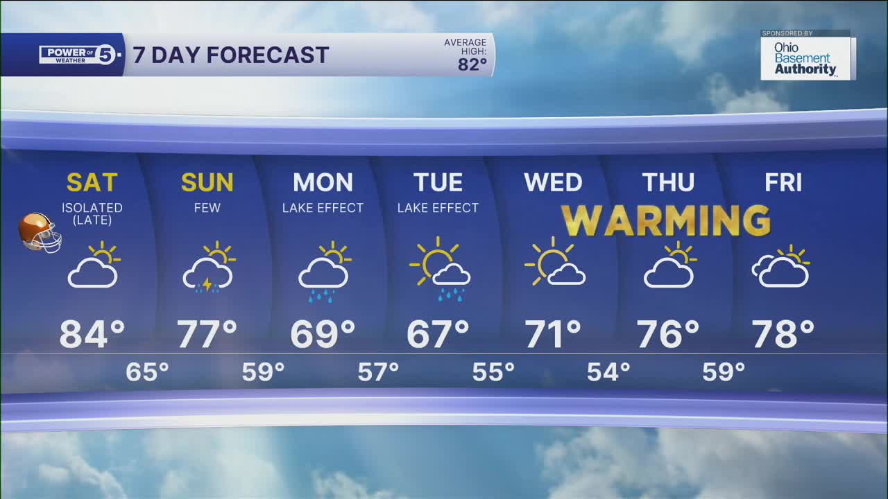
The shower chance increases a bit on Sunday with a few t-showers possible with a strong cold front that will roll through NEO. The best chance on Sunday looks to be in the eastern half of our viewing area. This means there will be TONS of dry time this weekend.
Following the cold front, temperatures will fall quickly into early next week with lake effect rain showers on Monday and Tuesday with highs in the SIXTIES! That is the coldest weather since June 1st, the last time the highs did not reach the 60s.
DAILY FORECAST:
Friday: Mostly sunny and warmer. | High: 80º
Saturday: Touch warmer. Plenty of dry time. Evening t-showers.| High: 84º
Sunday: A few t-showers.| High: 75º
Monday: A taste of fall. Lake effect rain showers are possible.| High: 69º
Tuesday: Even cooler. Lake effect rain showers are still possible.| High: 67º
Wednesday: Bright but still cool. | High: 70º
Want the latest Power of 5 weather team updates wherever you go? Download the News 5 App free now: Apple|Android
Click here to view our interactive radar.
Follow the News 5 Weather Team:
Trent Magill: Facebook & Twitter
Katie McGraw: Facebook & Twitter
Phil Sakal: Facebook & Twitter
Allan Nosoff: Facebook & Twitter
